Submit garden moth trap records

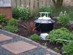
Use this page to enter records of moths caught in a garden moth trap.

This form includes automatic blurring of the spatial reference and site name of the record. This feature is enabled on this form because many people trap in their gardens and when the record is added to the system those details appear in public reports.


Previously, to prevent this happening, the recorder had to mark each species as sensitive (this was not ideal!). Using this form allows you to enter the full details about your records in the knowledge that your home address will not appear in the Explore > All Records reports.


The full information will still be available to CEDaR and verifiers but the public records reports will no longer include the site name and grid reference while the dot on the map will be blurred to 1km.


Important: if you use this site regularly, please remember to login.

This will give you access to the My Records report which allows you to manage your data.


Your details (please note: this information will be used for record verification purposes only by NIEA and CEDaR staff).
Your contact details
 
 
 *
 
Sample Method
 
 
Any additional recorder(s) names.
Date of your sighting.
*


Please add all the species you saw and any other information about them. The species box will auto-complete as you type.

Please note: if you have had an expert confirm the identification of a record please add their name in the 'Determiner' field. This will help when the record is being verified.

Step 1
{content} Select a species first
SpeciesAbundanceDeterminerStage (Moth)CertaintyCommentAdd photos


Please provide the spatial reference and site name for the record.
*

By clicking on the map the spatial reference will autofill.

*

The information you enter will not be included in public reports and the spatial reference will be blurred to 1km. This is to prevent postal addresses appearing in public reports.


Notes about using the map:
  • use the + sign on the right hand side of the map to change the base mapping used from Google to OpenStreetMap.
  • To create an accurate and useful record, use your mouse to drag the area of interest to the centre of the map window and use the zoombar on the left hand side to zoom in tight to the area where you made the sighting. When you have zoomed in, click on the location - this will autofill the Spatial Reference box above.