Submit records for Causeway Coast AONB

Causeway Coast AONB, part of the Causeway Coast and Glens Heritage Trust

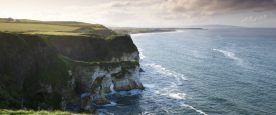
The Causeway Coast AONB covers 4,200ha of land and extends along 18 miles (29km) of spectacular, rugged and dramatic coastline between Portrush and Ballycastle.


Visit the Causeway Coast AONB website to find out more about the region. If you wish to submit records for the area, please use the form below.


Important: if you use this site regularly, please remember to login.

This will give you access to the My Records report which allows you to manage your data.



If you've got lots of records to submit, then we recommend breaking the records up into several batches as it is very easy to accidentally click the back button on the browser and lose the data entered so far.

Please enter the species you saw and any other information about them.

The Species field will autocomplete as you type.
Tip: add an asterisk (*) before the species name if you want to search for part of the name e.g. *porpoise will return both common and harbour porpoise. If you can't find the species using the common name, try using the scientific name. Click on the species you want to choose.)

Determiner: if you have had an expert confirm the identification of a record please add their name in the 'Determiner' field. This will help when the record is being verified.

Step 1
{content}
Select a species first
SpeciesCertaintyDeterminerAbundanceCommentSensitivityAdd photos


Please provide the spatial reference of the record
*

By clicking on the map the spatial reference will autofill. The more you zoom in, the more accurate the grid reference.

 *

For example the nearest town, village, park, nature reserve etc.
Please do not enter a postal address as the information you provide will be visible to others.

Notes about using the map:
  • use the + sign on the right hand side of the map to change the base mapping used from Google to OpenStreetMap.
  • To create an accurate and useful record, use your mouse to drag the area of interest to the centre of the map window and use the zoombar on the left hand side to zoom in tight to the area where you made the sighting. When you have zoomed in, click on the location - this will autofill the Spatial Reference box above.

Please provide a date for your sighting(s)
*
Please provide your contact details (note: this information will be used for record verification purposes).
 
 
 *
Any additional recorder(s).
Any additional comments.