Marine Biodiversity Data Portal - NI

Skernaghan Point, East of Larne
Survey number: 780 Event number: 20240831/02 Date: 2024-08-31 GPS: 54.86155,-5.76267. Depth: -15.0 to -25.0 m. [ View map ]
Site Description: Seabed of gravel and stones, scallops common. Bedrock closer to shore at end of transect; boulders and cobbles on shelly gravel, with branching bryozoans & Acrosorium venulosum
Species list (61 species recorded):
CNIDARIA
Hydrallmania falcata
Sertularella gayi
Sertularia argentea
Antennella secundaria
Halopteris catharina
Nemertesia antennina
Nemertesia ramosa
Aglaophenia tubulifera
Epizoanthus couchii
Actinothoe sphyrodeta
Caryophyllia smithii
ANNELIDA
Chaetopterus variopedatus
Lanice conchilega
Sabella pavonina
CRUSTACEA
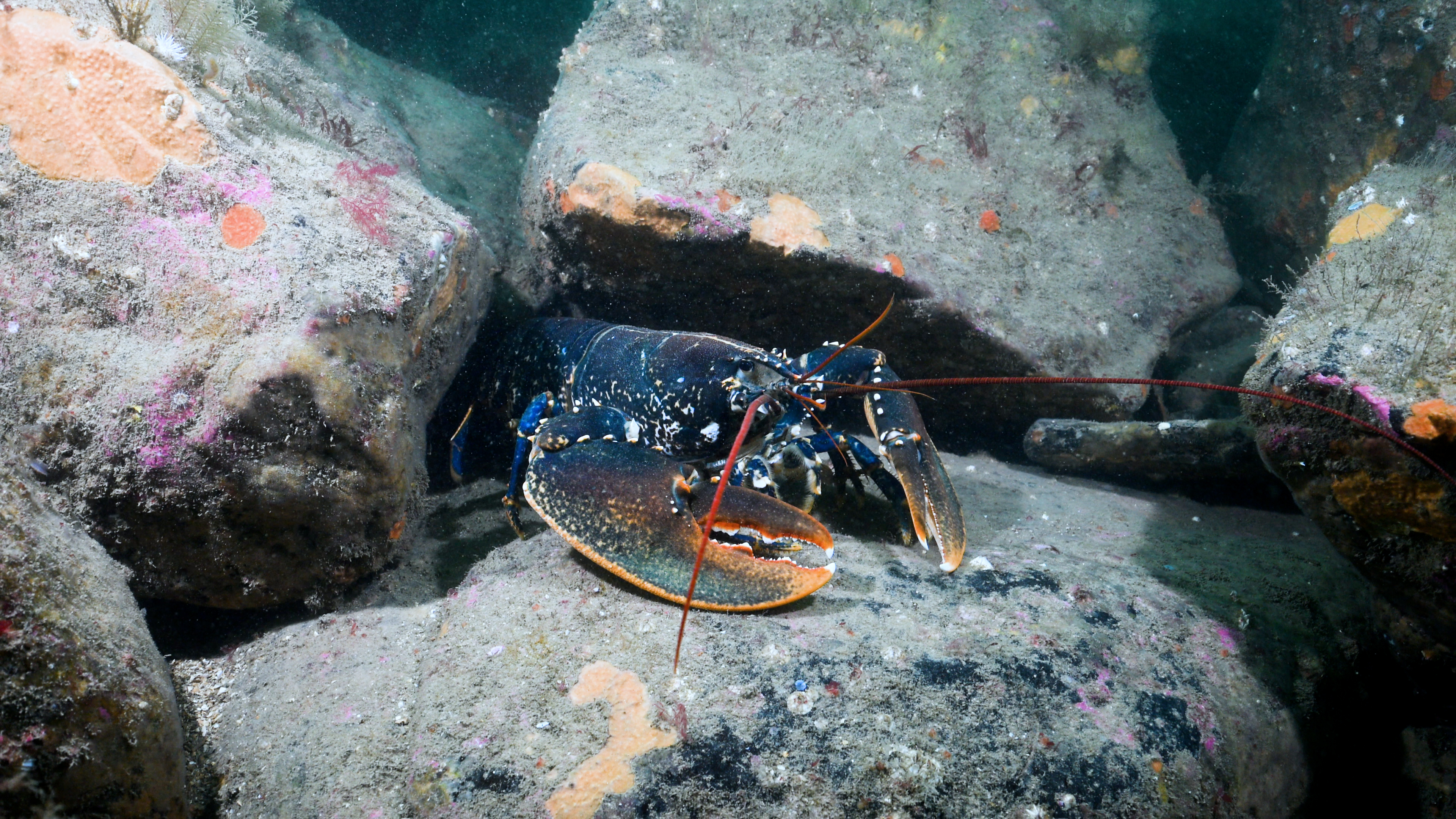
Homarus gammarus
Munida rugosa
MOLLUSCA
Ancula gibbosa
Crimora papillata
Doto sp.
Eubranchus tricolor
Pecten maximus
Polititapes rhomboides
BRYOZOA
Crisia denticulata
Alcyonidium diaphanum
Vesicularia spinosa
Eucratea loricata
Electra pilosa
Flustra foliacea
Securiflustra securifrons
Crisularia plumosa
Cellaria fistulosa
Parasmittina trispinosa
ECHINODERMATA
Anseropoda placenta
Crossaster papposus
Leptasterias muelleri
Marthasterias glacialis
Ophiothrix fragilis
Ophiocomina nigra
Ophiura albida
Echinus esculentus
Neopentadactyla mixta
TUNICATA
Corella parallelogramma
Ascidia mentula
Ascidia virginea
Styela clava
Polycarpa pomaria
Botryllus sp.
PISCES
Taurulus bubalis
Ctenolabrus rupestris
Labrus mixtus
Callionymus reticulatus
Thorogobius ephippiatus
RHODOPHYTA
Calliblepharis ciliata
Metacallophyllis laciniata
Kallymenia reniformis
Heterosiphonia plumosa
Acrosorium venulosum
Cryptopleura ramosa
Delesseria sanguinea
CHROMOPHYTA
Dictyota dichotoma
Saccharina latissima
Hydrallmania falcata
Sertularella gayi
Sertularia argentea
Antennella secundaria
Halopteris catharina
Nemertesia antennina
Nemertesia ramosa
Aglaophenia tubulifera
Epizoanthus couchii
Actinothoe sphyrodeta
Caryophyllia smithii
ANNELIDA
Chaetopterus variopedatus
Lanice conchilega
Sabella pavonina
CRUSTACEA
Homarus gammarus
Munida rugosa
MOLLUSCA
Ancula gibbosa
Crimora papillata
Doto sp.
Eubranchus tricolor
Pecten maximus
Polititapes rhomboides
BRYOZOA
Crisia denticulata
Alcyonidium diaphanum
Vesicularia spinosa
Eucratea loricata
Electra pilosa
Flustra foliacea
Securiflustra securifrons
Crisularia plumosa
Cellaria fistulosa
Parasmittina trispinosa
ECHINODERMATA
Anseropoda placenta
Crossaster papposus
Leptasterias muelleri
Marthasterias glacialis
Ophiothrix fragilis
Ophiocomina nigra
Ophiura albida
Echinus esculentus
Neopentadactyla mixta
TUNICATA
Corella parallelogramma
Ascidia mentula
Ascidia virginea
Styela clava
Polycarpa pomaria
Botryllus sp.
PISCES
Taurulus bubalis
Ctenolabrus rupestris
Labrus mixtus
Callionymus reticulatus
Thorogobius ephippiatus
RHODOPHYTA
Calliblepharis ciliata
Metacallophyllis laciniata
Kallymenia reniformis
Heterosiphonia plumosa
Acrosorium venulosum
Cryptopleura ramosa
Delesseria sanguinea
CHROMOPHYTA
Dictyota dichotoma
Saccharina latissima
Biotope 1 : Flustra foliacea and Hydrallmania falcata on tide-swept circalittoral mixed sediment. SS.SMx.CMx.FluHyd (EUNIS A5.444)
CNIDARIA
Hydrallmania falcata R
Sertularella gayi O
Sertularia argentea F
Antennella secundaria R
Halopteris catharina O
Nemertesia antennina O
Nemertesia ramosa O
Aglaophenia tubulifera O
Epizoanthus couchii R
Actinothoe sphyrodeta R
Caryophyllia smithii O
ANNELIDA
Chaetopterus variopedatus R
Lanice conchilega R
Sabella pavonina R
CRUSTACEA
Homarus gammarus R
Munida rugosa R
MOLLUSCA
Ancula gibbosa R
Crimora papillata O
Doto sp. R
Eubranchus tricolor R
Pecten maximus R
Polititapes rhomboides O
BRYOZOA
Crisia denticulata F
Crisia denticulata F
Alcyonidium diaphanum F
Vesicularia spinosa A
Eucratea loricata A
Electra pilosa O
Flustra foliacea A
Securiflustra securifrons C
Crisularia plumosa F
Cellaria fistulosa A
Parasmittina trispinosa F
ECHINODERMATA
Anseropoda placenta R
Crossaster papposus R
Leptasterias muelleri R
Marthasterias glacialis R
Ophiothrix fragilis R
Ophiocomina nigra O
Ophiura albida R
Echinus esculentus R
Neopentadactyla mixta R
TUNICATA
Corella parallelogramma R
Ascidia mentula R
Ascidia virginea R
Styela clava R
Polycarpa pomaria R
Botryllus sp. R
PISCES
Taurulus bubalis R
Ctenolabrus rupestris R
Labrus mixtus R
Callionymus reticulatus R
Thorogobius ephippiatus R
RHODOPHYTA
Calliblepharis ciliata R
Metacallophyllis laciniata R
Kallymenia reniformis O
Heterosiphonia plumosa F
Acrosorium venulosum A
Cryptopleura ramosa O
Delesseria sanguinea O
CHROMOPHYTA
Dictyota dichotoma R
Saccharina latissima O
| Previous site | Next site |