Marine Biodiversity Data Portal - NI

Kate's Pladdy, Strangford Lough
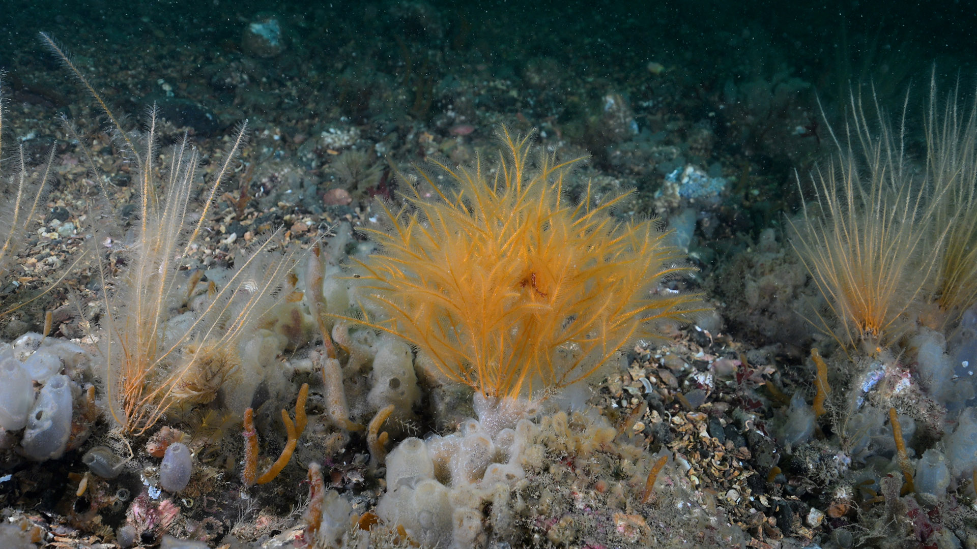
Survey number: 780 Event number: 20240803/01 Date: 2024-08-03 GPS: 54.40292,-5.58290. Depth: -12.0 to -18.0 m. [ View map ]
Site Description: Circalittoral mixed sediment (shell & gravel) with cobbles and boulders, seabed was covered in Diplosoma aff. listerianum and Ascidiella aspersa was superabundant.
Species list (56 species recorded):
PORIFERA
Sycon ciliatum
Cliona celata
Amphilectus fucorum
Mycale subclavata
CNIDARIA
Eudendrium sp.
Halecium halecinum
Halecium plumosum
Sertularella polyzonias
Sertularia argentea
Antennella secundaria
Halopteris catharina
Kirchenpaueria similis
Nemertesia antennina
Nemertesia ramosa
Plumularia setacea
Aglaophenia pluma
Aglaophenia tubulifera
Alcyonium digitatum
Caryophyllia smithii
ANNELIDA
Branchiomma bombyx
CRUSTACEA
Balanus crenatus
Inachus phalangium
Polybius depurator
Necora puber
MOLLUSCA
Okenia nodosa
Geitodoris planata
Edmundsella pedata
Anomia ephippium
BRYOZOA
Crisia denticulata
Alcyonidium diaphanum
Membranipora membranacea
Electra pilosa
Bugulina flabellata
Scrupocellaria sp.
PHORONIDA
Phoronis hippocrepia
ECHINODERMATA
Crossaster papposus
Henricia oculata
Asterias rubens
Echinus esculentus
TUNICATA
Clavelina lepadiformis
Morchellium argus
Diplosoma sp.
Diplosoma spongiforme
Lissoclinum perforatum
Ascidiella aspersa
Ascidiella scabra
PISCES
Trisopterus minutus
Ctenolabrus rupestris
Pomatoschistus sp.
RHODOPHYTA
Bonnemaisonia asparagoides
Stenogramma interruptum
Plocamium sp.
Heterosiphonia plumosa
Delesseria sanguinea
CHROMOPHYTA
Desmarestia aculeata
Saccharina latissima
Biotope 1 : Circalittoral mixed sediment. SS.SMx.CMx (EUNIS A5.44)
PORIFERA
Sycon ciliatum R
Cliona celata R
Amphilectus fucorum R
Mycale subclavata F
CNIDARIA
Eudendrium sp. O
Halecium halecinum R
Halecium plumosum O
Sertularella polyzonias O
Sertularia argentea O
Antennella secundaria R
Halopteris catharina R
Kirchenpaueria similis O
Nemertesia antennina C
Nemertesia ramosa F
Plumularia setacea R
Aglaophenia pluma R
Aglaophenia tubulifera O
Alcyonium digitatum R
Caryophyllia smithii R
ANNELIDA
Branchiomma bombyx R
CRUSTACEA
Balanus crenatus C
Inachus phalangium R
Polybius depurator R
Necora puber O
MOLLUSCA
Okenia nodosa R
Geitodoris planata R
Edmundsella pedata R
Anomia ephippium R
BRYOZOA
Crisia denticulata O
Alcyonidium diaphanum C
Membranipora membranacea F
Electra pilosa R
Bugulina flabellata F
Scrupocellaria sp. O
PHORONIDA
Phoronis hippocrepia R
ECHINODERMATA
Crossaster papposus R
Henricia oculata R
Asterias rubens R
Echinus esculentus O
TUNICATA
Clavelina lepadiformis R
Morchellium argus R
Diplosoma sp. O
Diplosoma spongiforme O
Lissoclinum perforatum R
Ascidiella aspersa S
Ascidiella scabra F
PISCES
Trisopterus minutus R
Ctenolabrus rupestris R
Pomatoschistus sp. R
RHODOPHYTA
Bonnemaisonia asparagoides F
Stenogramma interruptum O
Plocamium sp. R
Heterosiphonia plumosa O
Delesseria sanguinea R
CHROMOPHYTA
Desmarestia aculeata R
Saccharina latissima R
| Previous site | Next site |