Marine Biodiversity Data Portal - NI

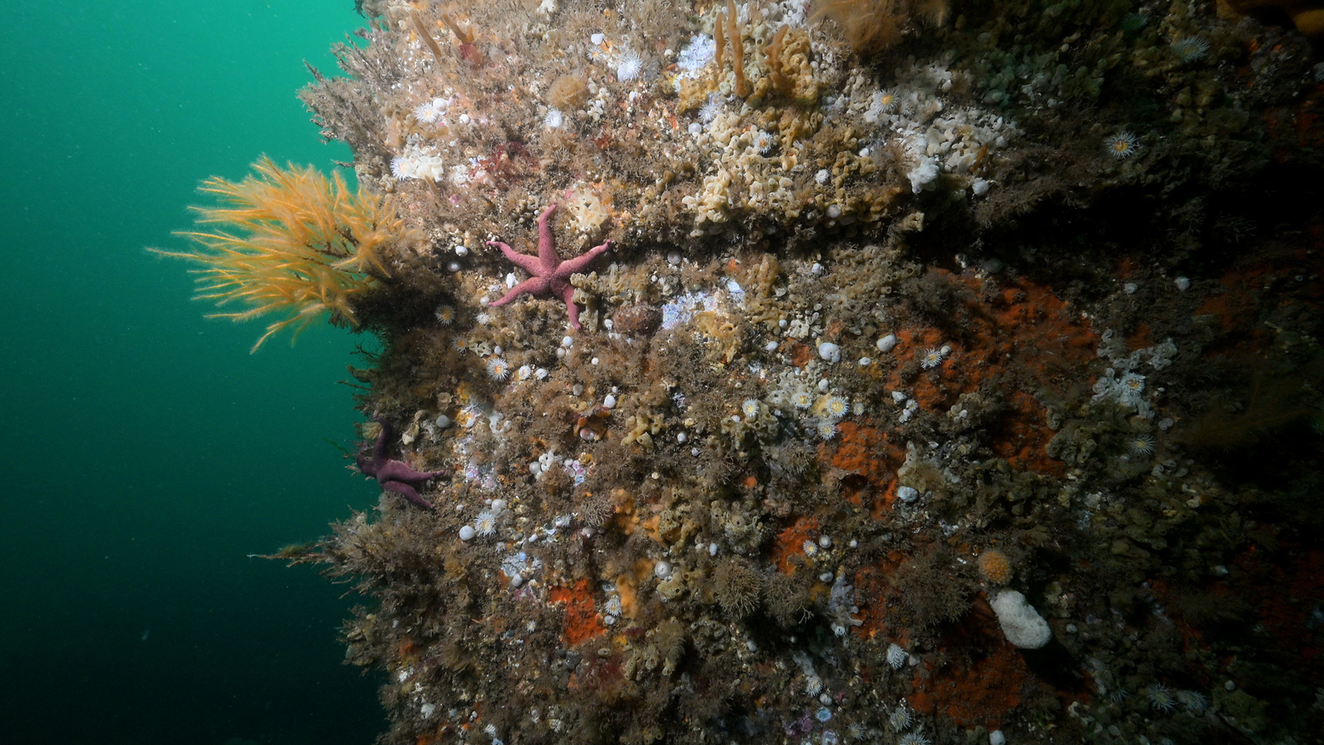
Wreck of Empire Tana, Lee's wreck, Ballyhenry Point, Strangford Lough
Survey number: 780 Event number: 20240802/01 Date: 2024-08-02 GPS: 54.38919,-5.57297. Depth: -8.0 to -12.0 m. [ View map ]
Site Description: Outer Lee's wreck (Empire Tana). Circalittoral rock/hard substrata, mixed seabed of stones, boulders and gravel, sheltered with strong tidal streams.
Species list (57 species recorded):
PORIFERA
Sycon ciliatum
Dysidea fragilis
Cliona celata
Microciona atrasanguinea
CNIDARIA
Coryne eximia
Abietinaria abietina
Hydrallmania falcata
Sertularella gayi
Sertularella polyzonias
Sertularia argentea
Kirchenpaueria pinnata
Nemertesia antennina
Nemertesia ramosa
Alcyonium digitatum
Epizoanthus couchii
Metridium senile
Actinothoe sphyrodeta
ANNELIDA
Sabella pavonina
Filograna implexa
CRUSTACEA
Balanus crenatus
Necora puber
MOLLUSCA
Steromphala cineraria
Calliostoma zizyphinum
Doto tuberculata
Diaphorodoris luteocincta
Acanthodoris pilosa
Rostanga rubra
Geitodoris planata
BRYOZOA
Alcyonidium diaphanum
Bugulina flabellata
Scrupocellaria sp.
Cellaria fistulosa
Parasmittina trispinosa
ECHINODERMATA
Crossaster papposus
Henricia oculata
Asterias rubens
Marthasterias glacialis
Echinus esculentus
TUNICATA
Clavelina lepadiformis
Morchellium argus
Aplidium punctum
Didemnidae sp.
Didemnum sp.
Diplosoma listerianum
Lissoclinum perforatum
Botryllus renierii
PISCES
Pollachius pollachius
Trisopterus minutus
Centrolabrus exoletus
Ctenolabrus rupestris
Labrus bergylta
Labrus mixtus
Parablennius gattorugine
Callionymus reticulatus
RHODOPHYTA
Stenogramma interruptum
Cryptopleura ramosa
CHROMOPHYTA
Dictyota dichotoma
Biotope 1 : Circalittoral rock/hard subtrata, high energy, extremely tideswept. CR.HCR.FaT.Ctub.Adig (EUNIS A4.1122)
PORIFERA
Sycon ciliatum O
Dysidea fragilis R
Cliona celata O
Microciona atrasanguinea C
CNIDARIA
Coryne eximia O
Abietinaria abietina F
Hydrallmania falcata F
Sertularella gayi F
Sertularella polyzonias F
Sertularia argentea C
Kirchenpaueria pinnata O
Nemertesia antennina C
Nemertesia ramosa C
Alcyonium digitatum F
Epizoanthus couchii O
Metridium senile O
Actinothoe sphyrodeta F
ANNELIDA
Sabella pavonina R
Filograna implexa O
CRUSTACEA
Balanus crenatus C
Necora puber R
MOLLUSCA
Steromphala cineraria R
Calliostoma zizyphinum R
Doto tuberculata R
Diaphorodoris luteocincta R
Acanthodoris pilosa R
Rostanga rubra R
Geitodoris planata R
BRYOZOA
Alcyonidium diaphanum O
Bugulina flabellata F
Scrupocellaria sp. O
Cellaria fistulosa F
Parasmittina trispinosa R
ECHINODERMATA
Crossaster papposus R
Henricia oculata R
Asterias rubens R
Marthasterias glacialis O
Echinus esculentus R
TUNICATA
Clavelina lepadiformis R
Morchellium argus O
Aplidium punctum R
Didemnidae sp. C
Didemnum sp. C
Diplosoma listerianum F
Lissoclinum perforatum O
Botryllus renierii R
PISCES
Pollachius pollachius R
Trisopterus minutus R
Centrolabrus exoletus R
Ctenolabrus rupestris O
Labrus bergylta R
Labrus mixtus R
Parablennius gattorugine R
Callionymus reticulatus O
RHODOPHYTA
Stenogramma interruptum O
Cryptopleura ramosa O
CHROMOPHYTA
Dictyota dichotoma O
| Previous site | Next site |