Marine Biodiversity Data Portal - NI

S.S. Lochgarry, Rathlin Island
Survey number: 780 Event number: 20240519/02 Date: 2024-05-19 GPS: 55.26595,-6.17392. Depth: -27.0 to -32.0 m. [ View map ]
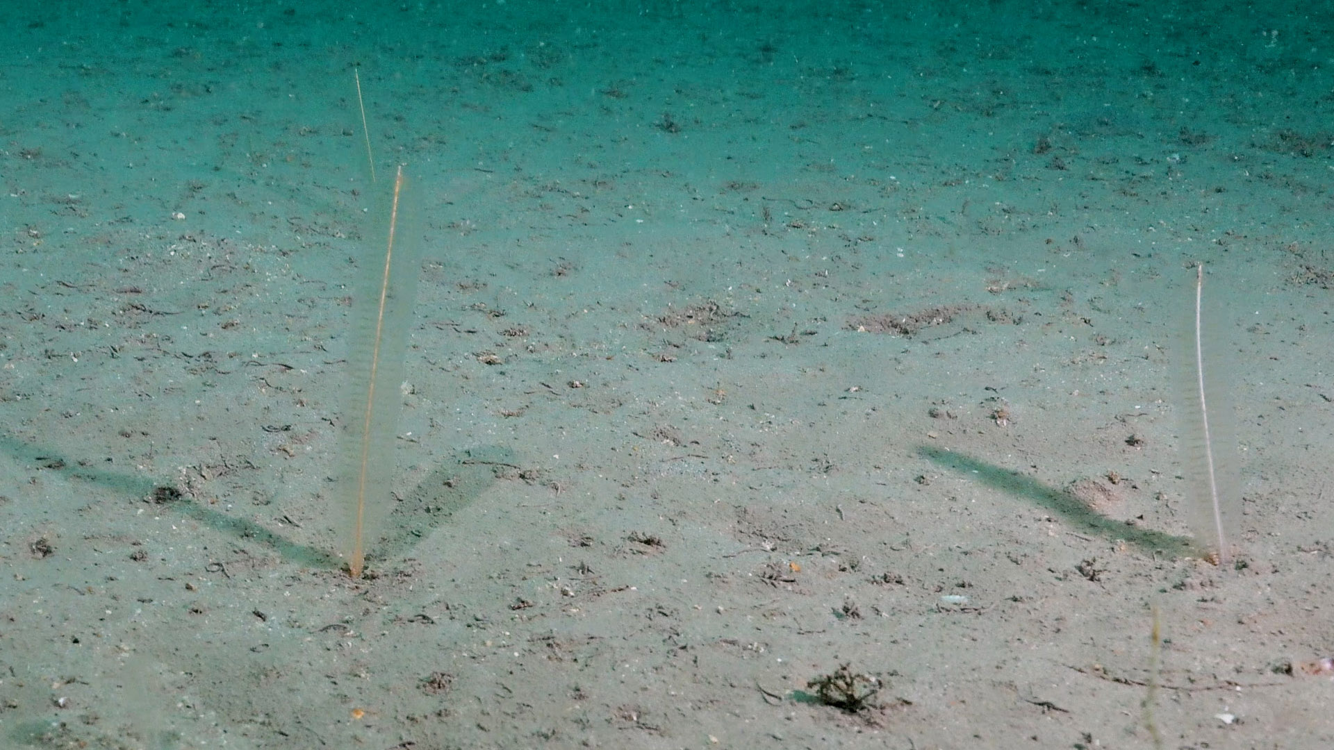
Site Description: Wreck of S.S. Lochgarry and adjacent seabed of boulders with muddy sand, with very tide-swept faunal communities. Circalittoral tide-swept mixed gravel, stone and boulders, wave-sheltered, with deep-water hydroids and sponges. Areas of muddy sand in the lee of the wreck with sea pens (Virgularia mirabilis) and many free-living cup corals at the surface of the gravel near the wreck.
 |
 |
 |
 |
 |
 |
 |
 |
 |
 |
 |
 |
 |
 |
 |
 |
 |
 |
 |
 |
 |
 |
 |
 |
 |
 |
 |
 |
 |
 |
 |
 |
 |
 |
 |
 |
 |
 |
 |
 |
 |
 |
 |
 |
Species list (51 species recorded):
Dysidea fragilis
Pachymatisma johnstonia
Axinella dissimilis
Axinella infundibuliformis
Eurypon sp.
Raspailia hispida
Raspailia ramosa
Stelligera stuposa
Polymastia boletiformis
Cliona celata
Hemimycale columella
Hymedesmia jecusculum
Hymedesmia paupertas
Myxilla fimbriata
Myxilla incrustans
Suberites carnosus
Haliclona sp.
CNIDARIA
Tubularia indivisa
Halecium halecinum
Diphasia alata
Diphasia margareta
Sertularella polyzonias
Kirchenpaueria pinnata
Nemertesia antennina
Polyplumaria flabellata
Aglaophenia tubulifera
Alcyonium digitatum
Virgularia mirabilis
Synarachnactis lloydii
Epizoanthus couchii
Metridium senile
Cylista elegans
Actinothoe sphyrodeta
Caryophyllia smithii
ANNELIDA
Lanice conchilega
Salmacina dysteri
CRUSTACEA
Palinurus elephas
MOLLUSCA
Polycera faeroensis
Edmundsella pedata
BRYOZOA
Flustra foliacea
Securiflustra securifrons
Cellaria fistulosa
Porella compressa
Pentapora foliacea
ECHINODERMATA
Crossaster papposus
Henricia oculata
Marthasterias glacialis
TUNICATA
Didemnum sp.
Diazona violacea
Ascidia mentula
PISCES
Centrolabrus exoletus
Biotope 1 : Circalittoral tide-swept boulders, wave-sheltered, with deep-water hydroids and sponges. Deep sponge communities (circalittoral). CR.HCR.DpSp (EUNIS A4.12)
Dysidea fragilis R
Pachymatisma johnstonia R
Axinella dissimilis R
Axinella infundibuliformis F
Raspailia hispida C
Raspailia ramosa O
Stelligera stuposa C
Polymastia boletiformis O
Cliona celata O
Hemimycale columella O
Hymedesmia jecusculum R
Myxilla fimbriata O
Myxilla incrustans R
Suberites carnosus R
Haliclona sp. R
CNIDARIA
Tubularia indivisa F
Halecium halecinum O
Diphasia alata O
Diphasia margareta R
Sertularella polyzonias R
Kirchenpaueria pinnata O
Nemertesia antennina C
Polyplumaria flabellata O
Aglaophenia tubulifera R
Alcyonium digitatum O
Virgularia mirabilis C
Synarachnactis lloydii R
Epizoanthus couchii R
Cylista elegans R
Actinothoe sphyrodeta O
Caryophyllia smithii A
Caryophyllia smithii O
ANNELIDA
Lanice conchilega O
Salmacina dysteri R
CRUSTACEA
Palinurus elephas O
MOLLUSCA
Polycera faeroensis O
Edmundsella pedata O
BRYOZOA
Flustra foliacea C
Securiflustra securifrons F
Cellaria fistulosa F
Porella compressa O
Pentapora foliacea F
ECHINODERMATA
Crossaster papposus R
Henricia oculata R
Marthasterias glacialis R
TUNICATA
Didemnum sp. F
Diazona violacea R
Ascidia mentula O
PISCES
Centrolabrus exoletus R
Biotope 2 : Wreck. Very tide-swept faunal communities. CR.HCR.FaT (EUNIS A4.11)
Eurypon sp. F
Hymedesmia paupertas F
CNIDARIA
Nemertesia antennina A
Alcyonium digitatum F
Metridium senile C
Metridium senile F
Caryophyllia smithii A
CRUSTACEA
Palinurus elephas R
Biotope 3 : Areas of muddy sand in the lee of the wreck with sea pens (Virgularia mirabilis) and many free-living cup corals at the surface of the gravel near the wreck. Sublittoral mixed sediment. SS.SMx (EUNIS A5.4)
Virgularia mirabilis C
Synarachnactis lloydii C
ANNELIDA
Lanice conchilega O
ECHINODERMATA
Crossaster papposus R
| Previous site | Next site |