Marine Biodiversity Data Portal - NI

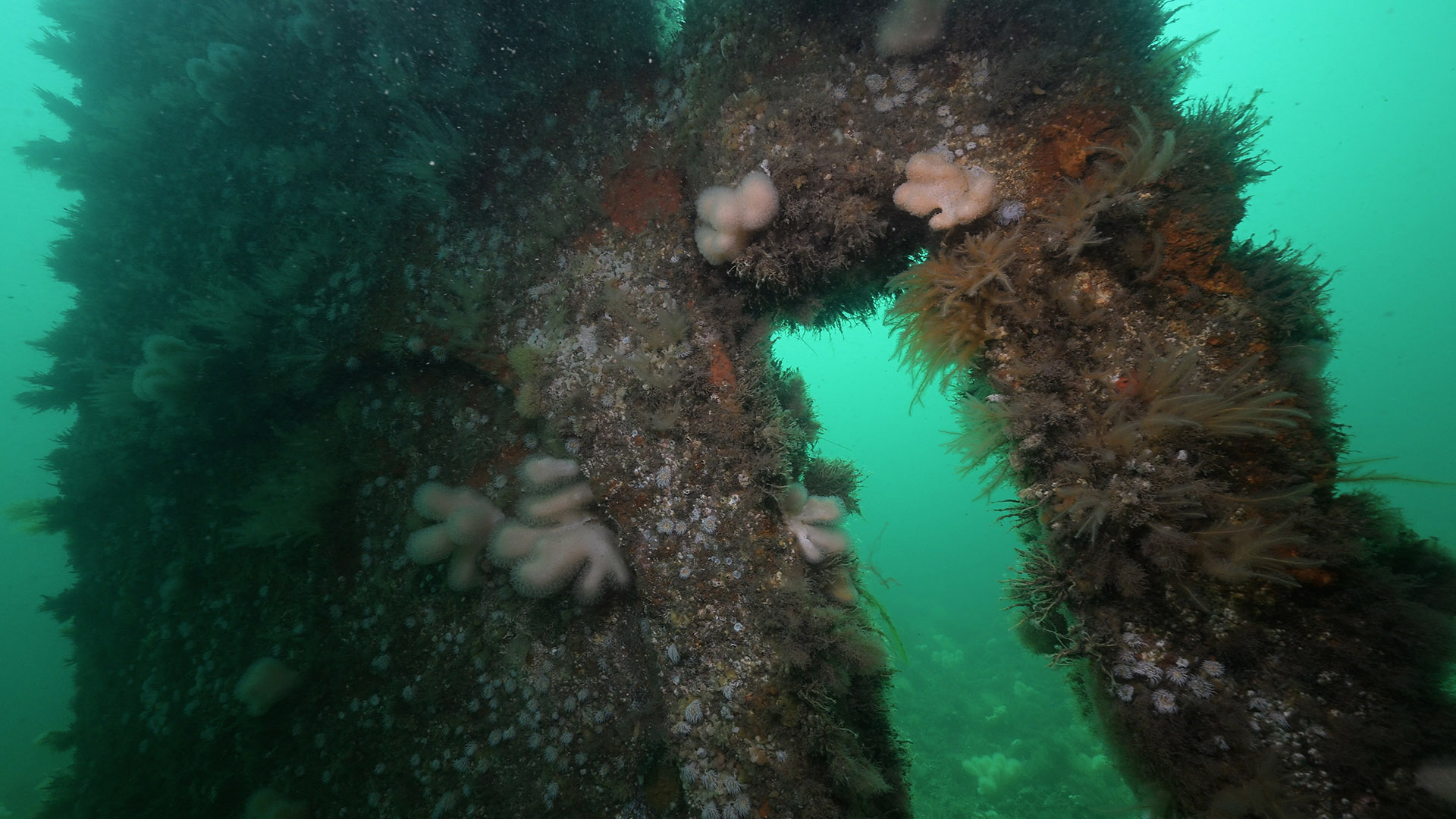
Wreck of Empire Tana, Lee's wreck, Ballyhenry Point, Strangford Lough
Survey number: 780 Event number: 20240601/01 Date: 2024-06-01 GPS: 54.38913,-5.57299. Depth: -6.0 to -12.0 m. [ View map ]
Site Description: Mixed seabed of stones, boulders and gravel, sheltered with strong tidal streams.
Species list (54 species recorded):
PORIFERA
Grantia compressa
Leucosolenia botryoides
Sycon ciliatum
Dysidea fragilis
Cliona celata
Microciona atrasanguinea
CNIDARIA
Tubularia indivisa
Ectopleura larynx
Coryne eximia
Garveia nutans
Abietinaria abietina
Amphisbetia operculata
Sertularella gayi
Sertularella polyzonias
Sertularia argentea
Kirchenpaueria pinnata
Nemertesia antennina
Nemertesia ramosa
Rhizocaulus verticillatus
Alcyonium digitatum
Epizoanthus couchii
Actinothoe sphyrodeta
CRUSTACEA
Balanus crenatus
MOLLUSCA
Calliostoma zizyphinum
Trivia arctica
Doto fragilis
Diaphorodoris luteocincta
Rostanga rubra
Geitodoris planata
BRYOZOA
Alcyonidium diaphanum
Bugulina flabellata
Cellaria fistulosa
Parasmittina trispinosa
ECHINODERMATA
Henricia oculata
Asterias rubens
Echinus esculentus
TUNICATA
Clavelina lepadiformis
Morchellium argus
Aplidium punctum
Didemnidae sp.
Diplosoma spongiforme
Ascidiella scabra
Ascidia mentula
PISCES
Pollachius pollachius
Centrolabrus exoletus
Ctenolabrus rupestris
Labrus bergylta
RHODOPHYTA
Plocamium lyngbyanum
Heterosiphonia plumosa
Cryptopleura ramosa
Delesseria sanguinea
CHROMOPHYTA
Desmarestia viridis
Saccharina latissima
CHLOROPHYTA
Ulva sp.
Biotope 1 : Circalittoral rock/hard subtrata, high energy, extremely tideswept. CR.HCR.FaT.Ctub.Adig (EUNIS A4.1122)
PORIFERA
Grantia compressa R
Leucosolenia botryoides O
Sycon ciliatum R
Dysidea fragilis O
Cliona celata C
Microciona atrasanguinea C
CNIDARIA
Tubularia indivisa F
Ectopleura larynx F
Coryne eximia F
Garveia nutans R
Abietinaria abietina F
Amphisbetia operculata F
Sertularella gayi F
Sertularella polyzonias F
Sertularia argentea A
Kirchenpaueria pinnata O
Nemertesia antennina C
Nemertesia ramosa C
Rhizocaulus verticillatus R
Alcyonium digitatum C
Epizoanthus couchii C
Actinothoe sphyrodeta C
CRUSTACEA
Balanus crenatus C
MOLLUSCA
Calliostoma zizyphinum R
Trivia arctica R
Doto fragilis R
Diaphorodoris luteocincta R
Rostanga rubra R
Geitodoris planata R
BRYOZOA
Alcyonidium diaphanum O
Bugulina flabellata F
Cellaria fistulosa O
Parasmittina trispinosa O
ECHINODERMATA
Henricia oculata R
Asterias rubens F
Echinus esculentus F
TUNICATA
Clavelina lepadiformis A
Morchellium argus O
Aplidium punctum O
Didemnidae sp. F
Diplosoma spongiforme R
Ascidiella scabra F
Ascidia mentula R
PISCES
Pollachius pollachius O
Centrolabrus exoletus O
Ctenolabrus rupestris F
Labrus bergylta R
RHODOPHYTA
Plocamium lyngbyanum O
Heterosiphonia plumosa A
Cryptopleura ramosa F
Delesseria sanguinea O
CHROMOPHYTA
Desmarestia viridis R
Saccharina latissima R
CHLOROPHYTA
Ulva sp. R
| Previous site | Next site |