Earth Science Conservation Review
| Dunnaglea-Larry Bane Bay | Antrim |

| Site Type: | Coastal section |
| Site Status: | PART ASSI |
| Council area: | Moyle District Council |
| Grid Reference: | D033451,D059448 |
| Google maps: | 55.24252,-6.37593 |
| Rocks | |
|---|---|
| Rock Age: | Cretaceous (Campanian, Santonian) |
| Rock Name: | Ballintoy Chalk Member, Ballymagarry Chalk Member, Boheeshane Chalk Member, Cloghastucan Chalk Member, Creggan Chalk Member, Garron Chalk Member, Glenarm Chalk Member, Larry Bane Chalk Member, Portrush Chalk Member, Ulster White Limestone Formation |
| Rock Type: | Flint, Limestone |
| Interest | |
| Fossil Groups: | Ammonite, Belemnite, Echinoderm, Sponge |
| Other interest: | Marine sediments |
Summary of site:
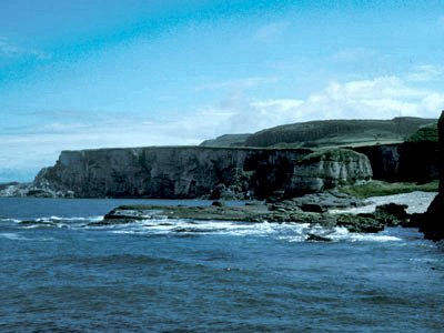
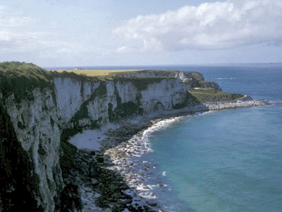
The spectacular coastline from just west of Ballintoy Harbour to the eastern end of Larry Bane Bay contains what is probably the most complete sequence of the Cretaceous Ulster White Limestone in Northern Ireland. The dazzling chalk cliffs dominate the coast for almost 4km and ten members of the Ulster White Limestone can be identified here.
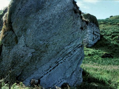
Starting at the western end of the section, just beyond the western end of Ballintoy Harbour at Dunnaglea, a collapsed sea stack lies on what is now a grassy raised beach. In this stack the first three members can be seen: the Galboly Chalk, the Cloghastucan Chalk and the Creggan Chalk.
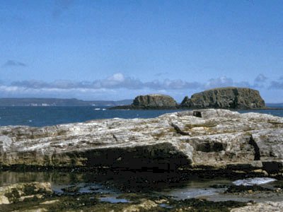
The Ballintoy Chalk Member's ‘type section' (the standard for comparison with all other exposures of this member) is in Ballintoy Harbour. The Bendoo volcanic plug (the feeder to a volcano) separates the Ballintoy Chalk type section from the succession to the east where the first beds to appear in Boheeshane Bay are the upper parts of the Creggan Chalk Member. The base of the overlying Boheeshane Chalk Member is defined by the Bendoo Pebble Bed, in which glauconised pebbles are actually fossils eroded out of earlier chalks during the Cretaceous. The fossils consist of sponges, sea urchins and belemnites and were damaged at the time by rolling on the shallow sea bed. The top of the Boheeshane Chalk is the base of the succeeding Larry Bane Chalk Member and is marked by a strong horizontal erosion surface. Three divisions can be seen in the Boheeshane Chalk: 1, a lower bed (over 8m thick) with small tabular flints and sparse green pebbles near its base; 2, a middle bed (over 8m thick) subdivided into six units with a continuous flint band about half way through it; and 3, a top bed (over 7m thick) with many prominent flint bands. The overlying Larry Bane Chalk Member is the most recognisable of all the chalks in the area. There are two units delimited by strongly developed erosion surfaces; the lower 2.4m thick, the upper twice that thickness. Both contain very large belemnites on exposed bedding planes. The Ballintoy Chalk Member is another consisting of two beds, the lower three times thicker than the upper. The lower half of this member contains many randomly dotted small nodular flints; the upper half is recognised by its small tabular flints. The base of the lower bed contains large sea urchins of the species Echinocorys conica, which are restricted to this horizon. The Altachuile Breccia, which marks the top of the Ballintoy Chalk, consists of pellets and larger fragments of hardened chalk with eroded flint chippings; but despite the obvious ripping up and fragmenting of earlier beds, perhaps by a storm, it also contains undamaged Offaster sea urchins that obviously colonised the sea bed quickly afterwards. The gently dipping beds in Ballintoy Harbour make up the type section already mentioned.
The various chalk members that together make up the Ulster White Limestone Formation on this coastline were laid down in the Santonian and Campanian stages of the Cretaceous, over a 10 million-year period starting around 85 million years ago. At that time (towards the close of the Age of the Dinosaurs), a fairly shallow and extensive limb of the infant North Atlantic Ocean covered almost all of the British Isles area. Only parts of Scotland and the north west of Ireland appear to have survived as land throughout. Although by this time the British Isles area lay in similar latitudes to today, the climate was markedly warmer (by anything up to 10ºC); the seas were correspondingly warm, rich in nutrients and clouded by countless billions of plankton (mainly protocists - miniscule plants which formed the base of the marine food chain). One particular group, the coccolithophoroids, were overwhelmingly dominant and their tiny calcium carbonate plates, only a few microns across, fell in an incessant rain on to the sea bed, forming a soft, creamy ooze that would eventually harden into chalk.
The history of these chalks in Northern Ireland is a complex one of deposition, marine regressions causing partial and total emergences, overlapping of earlier deposits by later, disruption by storm events and all accompanied by a series of faunal changes. It is further complicated by a peninsula, a spur of land extending from the northern Scottish area and marking the Highland Border Ridge (a major feature surviving from an earlier gigantic upheaval). This south-west trending peninsula divided the Cretaceous sea into two separate basins in the Northern Ireland area, the north-west Rathlin Basin and the south-east Larne / Lough Neagh Basin. Both have long and separate histories (although containing similar rock successions) right up to Ballintoy Chalk times when the Highland Border Ridge was finally breached.
This Area of Special Scientific Interest is of vital importance to our understanding of events in the Santonian and Campanian times of the late Cretaceous, particularly since it contains the stratotypes of the Boheeshane and Larry Bane Chalk Members in addition to the Ballintoy Chalk. In the Irish context, the Northern Ireland Cretaceous chalks are just about all that remain of extensive chalk deposits that must once have covered most of the Irish area. With the exception of small chalk-filled caves in the south west, they are the only Cretaceous rocks to be seen in Ireland. This is entirely due to the protective cover that the Tertiary volcanic rocks provided against later erosion.
This imposing and popular coastline should be protected from any developments likely to obscure the cliffs or damage their natural setting.
| Enlander, I., Dempster, M. & Doughty, P., 2025. Dunnaglea-Larry Bane Bay, County Antrim, site summary. [In] Earth Science Conservation Review. https://www.habitas.org.uk/escr/summary.php?item=1209. Accessed on 2025-04-03 |
| Previous Site | Next Site |


