Otter Survey

Through this project, CEDaR aims to closely align where possible with the previous surveys.
To establish presence/absence of the species in waterbodies across the country, to make an estimation of the population and to establish the wellbeing of the species overall across Northern Ireland.

The results of the survey work will be used to inform the upcoming round of Habitats Regulations Reporting (HRR, previously known as Article 17 Reporting).

Your assistance in the study is gratefully appreciated.

otter 2
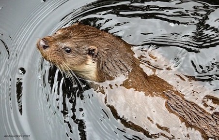
Photo: Andrea Bohl 2022
Please provide as much information as possible about your Otter sighting(s).
What was observed?
*
*
*

Please note: if you have had an expert confirm the identification of a record please add their name in the 'Determiner' field. This will help when the record is being verified.

Your details.
Your contact details
 *
 *
 *
 
Any additional recorder(s) names.
Date of your sighting.
*
Please provide the spatial reference and site name for the record.
*

By clicking on the map the spatial reference will autofill. The more you zoom in, the more accurate the grid reference.

*

For example the nearest town, village, park, nature reserve etc.
Do not enter a postal address as the information you provide will be visible to others.


Notes about using the map:
  • use the + sign on the right hand side of the map to change the base mapping used from Google to OpenStreetMap.
  • To create an accurate and useful record, use your mouse to drag the area of interest to the centre of the map window and use the zoombar on the left hand side to zoom in tight to the area where you made the sighting. When you have zoomed in, click on the location - this will autofill the Spatial Reference box above.