Marine Biodiversity Data Portal - NI

Zara Shoal, Strangford Lough
Survey number: 782 Event number: 20250705/02 Date: 2025-07-05 GPS: 54.37885,-5.56285. Depth: -10.0 to -15.0 m. [ View map ]
Site Description: Mixed sediment of cobbles, gravel, dead shells and shelly gravel with foliose red algae.
Species list (36 species recorded):
CNIDARIA
Abietinaria abietina
Hydrallmania falcata
Alcyonium digitatum
Synarachnactis lloydii
ANNELIDA
Chaetopterus sp.
Lanice conchilega
CRUSTACEA
Cancer pagurus
Polybius depurator
Necora puber
MOLLUSCA
Lutraria sp.
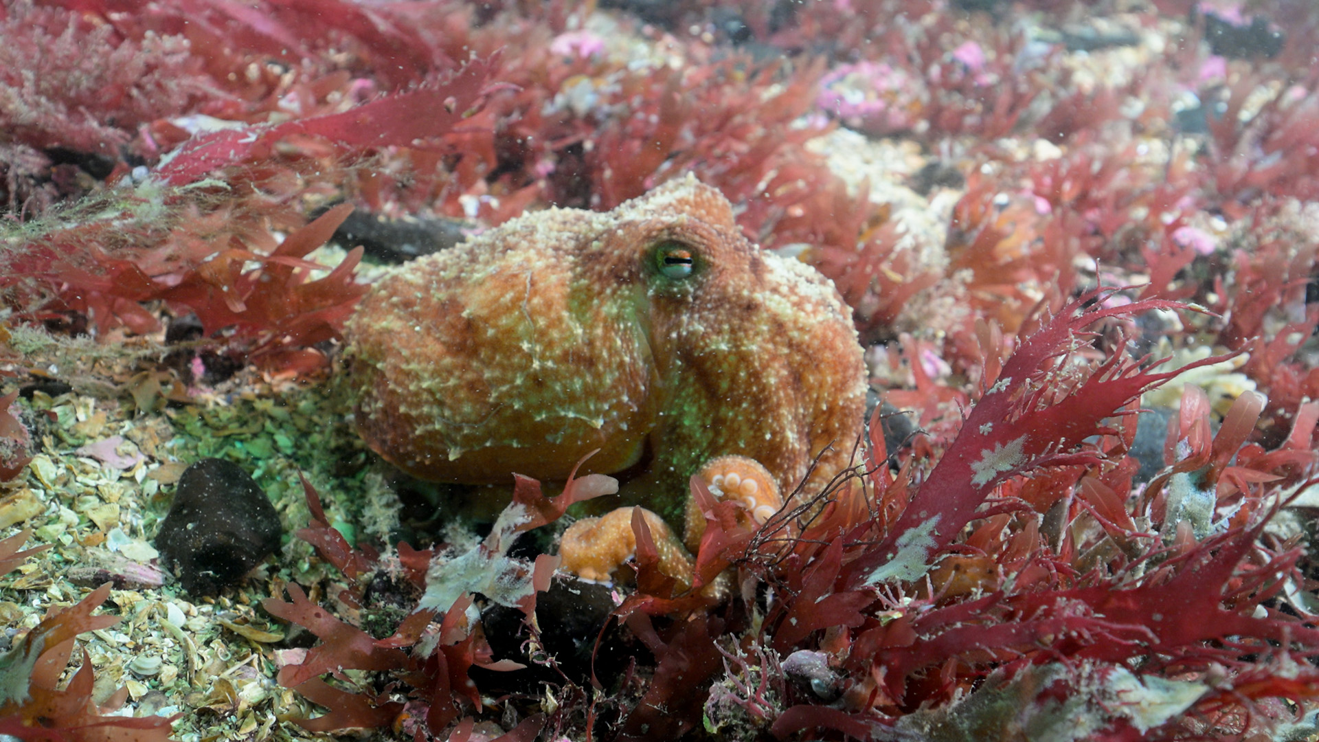
Eledone cirrhosa
BRYOZOA
Crisia denticulata
Alcyonidium diaphanum
Electra pilosa
Flustra foliacea
ECHINODERMATA
Crossaster papposus
Henricia oculata
Asterias rubens
Echinus esculentus
TUNICATA
Morchellium argus
RHODOPHYTA
Calliblepharis ciliata
Stenogramma interruptum
Plocamium lyngbyanum
Heterosiphonia plumosa
Acrosorium venulosum
Cryptopleura ramosa
Delesseria sanguinea
Nitophyllum punctatum
Phycodrys rubens
Odonthalia dentata
CHROMOPHYTA
Dictyota dichotoma
Desmarestia viridis
Laminaria hyperborea
Saccharina latissima
Ascophyllum nodosum
Fucus vesiculosus
Abietinaria abietina
Hydrallmania falcata
Alcyonium digitatum
Synarachnactis lloydii
ANNELIDA
Chaetopterus sp.
Lanice conchilega
CRUSTACEA
Cancer pagurus
Polybius depurator
Necora puber
MOLLUSCA
Lutraria sp.
Eledone cirrhosa
BRYOZOA
Crisia denticulata
Alcyonidium diaphanum
Electra pilosa
Flustra foliacea
ECHINODERMATA
Crossaster papposus
Henricia oculata
Asterias rubens
Echinus esculentus
TUNICATA
Morchellium argus
RHODOPHYTA
Calliblepharis ciliata
Stenogramma interruptum
Plocamium lyngbyanum
Heterosiphonia plumosa
Acrosorium venulosum
Cryptopleura ramosa
Delesseria sanguinea
Nitophyllum punctatum
Phycodrys rubens
Odonthalia dentata
CHROMOPHYTA
Dictyota dichotoma
Desmarestia viridis
Laminaria hyperborea
Saccharina latissima
Ascophyllum nodosum
Fucus vesiculosus
Biotope 1 : Circalittoral mixed sediment. SS.SMx.CMx (EUNIS A5.44)
CNIDARIA
Abietinaria abietina R
Hydrallmania falcata R
Alcyonium digitatum R
Synarachnactis lloydii R
ANNELIDA
Chaetopterus sp. R
Lanice conchilega R
CRUSTACEA
Cancer pagurus R
Polybius depurator R
Necora puber R
MOLLUSCA
Lutraria sp. O
Eledone cirrhosa R
BRYOZOA
Crisia denticulata O
Alcyonidium diaphanum R
Electra pilosa F
Flustra foliacea O
ECHINODERMATA
Crossaster papposus R
Henricia oculata R
Asterias rubens R
Echinus esculentus O
TUNICATA
Morchellium argus R
RHODOPHYTA
Calliblepharis ciliata F
Stenogramma interruptum A
Plocamium lyngbyanum O
Heterosiphonia plumosa C
Acrosorium venulosum O
Cryptopleura ramosa O
Delesseria sanguinea R
Nitophyllum punctatum R
Phycodrys rubens O
Odonthalia dentata R
CHROMOPHYTA
Dictyota dichotoma F
Desmarestia viridis O
Laminaria hyperborea O
Saccharina latissima R
Ascophyllum nodosum R
Fucus vesiculosus R
| Previous site | Next site |