Marine Biodiversity Data Portal - NI

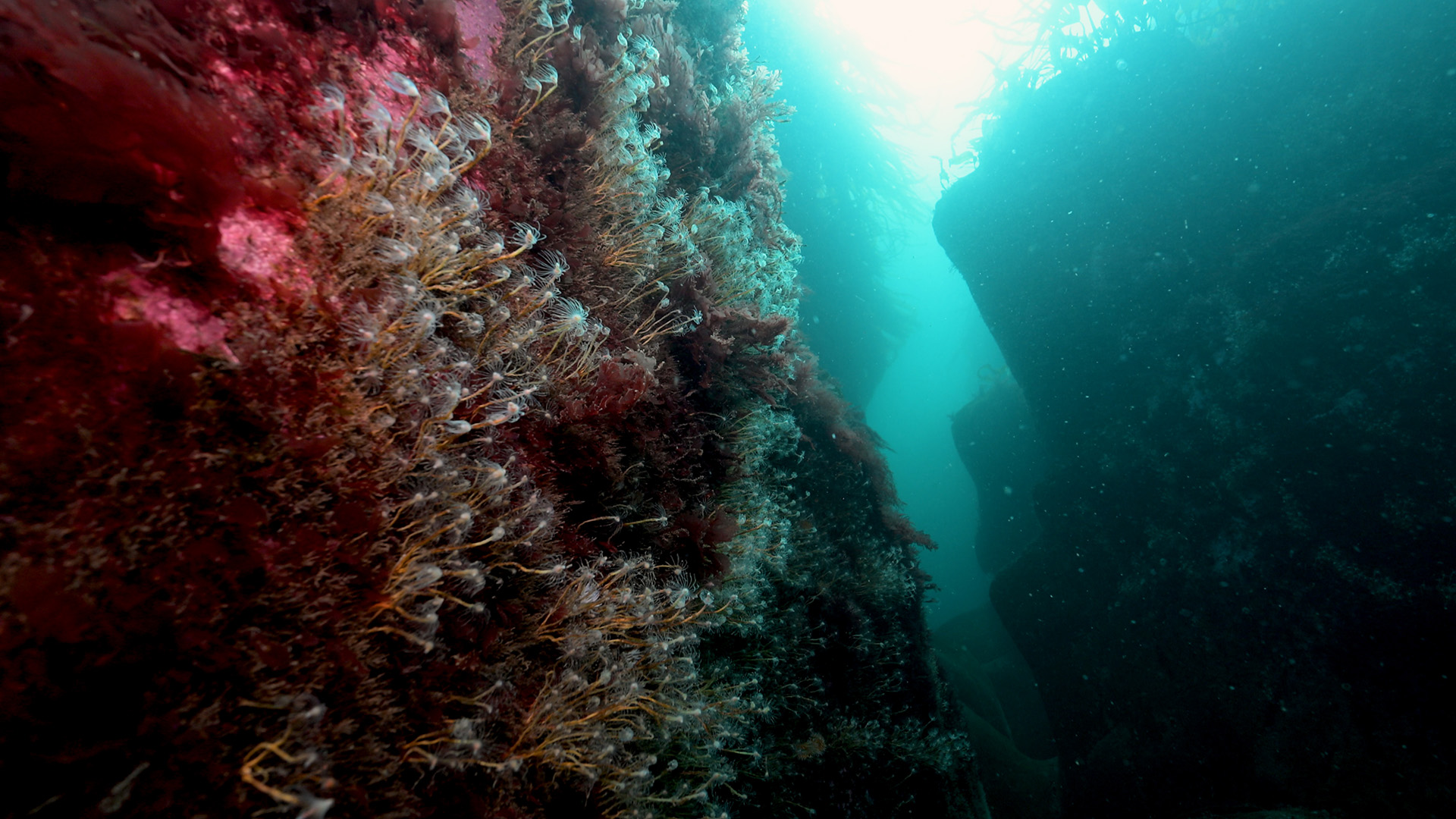
The Gully, Farganlack Point, Rathlin Island
Survey number: 782 Event number: 20250523/02 Date: 2025-05-23 GPS: 55.31093,-6.25625. Depth: -15.0 to -15.0 m. [ View map ]
Site Description: Gully with diverse anemones and sponges; kelp forest at top.
 |
 |
 |
 |
 |
 |
 |
 |
Species list (49 species recorded):
PORIFERA
Clathrina coriacea
Dysidea fragilis
Pachymatisma johnstonia
Hemimycale columella
Mycale rotalis
Myxilla incrustans
CNIDARIA
Cyanea lamarckii
Tubularia indivisa
Kirchenpaueria pinnata
Alcyonium digitatum
Cylista elegans
Actinothoe sphyrodeta
Phellia gausapata
Corynactis viridis
Caryophyllia smithii
ANNELIDA
Myrianida pinnigera
Circeis spirillum
CRUSTACEA
Homarus gammarus
Palinurus elephas
MOLLUSCA
Calliostoma zizyphinum
Trivia arctica
Hinia (Hima) incrassata
Cadlina laevis
Archidoris pseudoargus
Fjordia browni
Fjordia chriskaugei
Facelina auriculata
Talochlamys pusio
BRYOZOA
Crisia denticulata
Crisia eburnea
Plagioecia patina
ECHINODERMATA
Asterina phylactica
Henricia oculata
TUNICATA
Polyclinum aurantium
Sidnyum turbinatum
Aplidium nordmanni
Aplidium punctum
Diplosoma spongiforme
Dendrodoa grossularia
PISCES
Gadidae sp.
RHODOPHYTA
Rhodophyllis divaricata
Meredithia microphylla
Plocamium lyngbyanum
Heterosiphonia plumosa
Delesseria sanguinea
CHROMOPHYTA
Desmarestia aculeata
Alaria esculenta
Laminaria hyperborea
Saccorhiza polyschides
Biotope 1 : Laminaria hyperborea with dense foliose red seaweeds on exposed infralittoral rock. IR.HIR.KFaR.LhypR (EUNIS A3.115)
CNIDARIA
Cyanea lamarckii R
PISCES
Gadidae sp. R
RHODOPHYTA
Heterosiphonia plumosa F
Delesseria sanguinea C
CHROMOPHYTA
Alaria esculenta F
Laminaria hyperborea R
Saccorhiza polyschides P
Cyanea lamarckii R
PISCES
Gadidae sp. R
RHODOPHYTA
Heterosiphonia plumosa F
Delesseria sanguinea C
CHROMOPHYTA
Alaria esculenta F
Laminaria hyperborea R
Saccorhiza polyschides P
Biotope 2 : Sponges and anemones on vertical circalittoral bedrock. CR.HCR.XFa.SpAnVt (EUNIS A4.139)
PORIFERA
Clathrina coriacea C
Dysidea fragilis O
Pachymatisma johnstonia F
Hemimycale columella R
Mycale rotalis P
Myxilla incrustans O
CNIDARIA
Tubularia indivisa A
Kirchenpaueria pinnata R
Alcyonium digitatum O
Cylista elegans A
Actinothoe sphyrodeta C
Phellia gausapata F
Corynactis viridis O
Caryophyllia smithii O
ANNELIDA
Myrianida pinnigera O
Myrianida pinnigera R
Circeis spirillum R
CRUSTACEA
Homarus gammarus R
Palinurus elephas R
MOLLUSCA
Calliostoma zizyphinum R
Trivia arctica R
Hinia (Hima) incrassata R
Cadlina laevis R
Archidoris pseudoargus R
Fjordia browni F
Fjordia chriskaugei O
Facelina auriculata R
Talochlamys pusio P
BRYOZOA
Crisia denticulata F
Crisia eburnea S
Plagioecia patina O
ECHINODERMATA
Asterina phylactica F
Henricia oculata R
TUNICATA
Polyclinum aurantium O
Sidnyum turbinatum O
Aplidium nordmanni O
Aplidium punctum A
Diplosoma spongiforme R
Dendrodoa grossularia A
RHODOPHYTA
Rhodophyllis divaricata F
Meredithia microphylla P
Plocamium lyngbyanum F
Delesseria sanguinea F
CHROMOPHYTA
Desmarestia aculeata R
| Previous site | Next site |