Marine Biodiversity Data Portal - NI

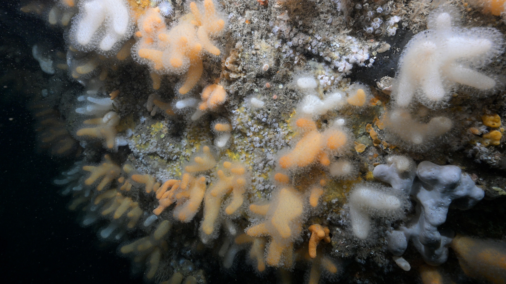
Ruecallan Archway, Rathlin Island
Survey number: 782 Event number: 20250522/01 Date: 2025-05-22 GPS: 55.30763,-6.26767. Depth: -10.0 to -32.0 m. [ View map ]
Site Description: Vertical limestone wall with archway on Rathlin's north wall.
 |
 |
 |
 |
 |
 |
 |
 |
Species list (60 species recorded):
PORIFERA
Stryphnus ponderosus
Pachymatisma johnstonia
Dercitus bucklandi
Axinella damicornis
Axinella dissimilis
Axinella infundibuliformis
Raspailia hispida
Raspailia ramosa
Tethyspira spinosa
Stelligera stuposa
Polymastia boletiformis
Polymastia penicillus
Sphaerotylus renoufi
Tethya citrina
Hemimycale columella
Phorbas fictitius
Desmacella cf. annexa
Spongosorites calcicola
Haliclona viscosa
CNIDARIA
Tubularia indivisa
Halecium halecinum
Nemertesia antennina
Nemertesia ramosa
Aglaophenia tubulifera
Obelia geniculata
Alcyonium digitatum
Epizoanthus couchii
Parazoanthus anguicomus
Parazoanthus axinellae
Actinothoe sphyrodeta
Caryophyllia smithii
ANNELIDA
Filograna implexa
CRUSTACEA
Adna anglica
Cancer pagurus
MOLLUSCA
Colpodaspis pusilla
Polycera faeroensis
Edmundsella pedata
BRYOZOA
Crisia denticulata
Crisia eburnea
Plagioecia patina
Caberea boryi
Cellaria sp.
Porella compressa
Parasmittina trispinosa
ECHINODERMATA
Henricia oculata
Marthasterias glacialis
Ophiactis balli
Echinus esculentus
TUNICATA
Clavelina lepadiformis
Polyclinum aurantium
Aplidium nordmanni
Aplidium punctum
Didemnidae sp.
Ascidia mentula
Ascidia virginea
PISCES
Labrus bergylta
RHODOPHYTA
Rhodophyllis divaricata
Delesseria sanguinea
Phycodrys rubens
CHROMOPHYTA
Laminaria hyperborea
Biotope 1 : Vertical limestone wall and archway (Sponges and anemones on vertical circalittoral bedrock). CR.HCR.XFa.SpAnVt (EUNIS A4.139)
PORIFERA
Stryphnus ponderosus P
Pachymatisma johnstonia F
Dercitus bucklandi F
Axinella damicornis R
Axinella dissimilis R
Axinella infundibuliformis C
Raspailia hispida C
Raspailia ramosa R
Tethyspira spinosa R
Stelligera stuposa C
Polymastia boletiformis F
Polymastia penicillus R
Sphaerotylus renoufi O
Tethya citrina F
Hemimycale columella R
Phorbas fictitius O
Desmacella cf. annexa O
Spongosorites calcicola O
Haliclona viscosa F
CNIDARIA
Tubularia indivisa O
Halecium halecinum F
Nemertesia antennina C
Nemertesia ramosa O
Aglaophenia tubulifera F
Alcyonium digitatum C
Epizoanthus couchii O
Parazoanthus anguicomus C
Parazoanthus axinellae C
Actinothoe sphyrodeta F
Caryophyllia smithii A
ANNELIDA
Filograna implexa R
CRUSTACEA
Adna anglica F
Cancer pagurus R
MOLLUSCA
Colpodaspis pusilla P
Polycera faeroensis R
Edmundsella pedata R
BRYOZOA
Crisia denticulata C
Crisia eburnea C
Plagioecia patina O
Caberea boryi F
Cellaria sp. O
Porella compressa O
Parasmittina trispinosa O
ECHINODERMATA
Henricia oculata R
Marthasterias glacialis R
Ophiactis balli P
Echinus esculentus R
TUNICATA
Clavelina lepadiformis R
Polyclinum aurantium O
Aplidium nordmanni O
Aplidium punctum F
Didemnidae sp. O
Ascidia mentula R
Ascidia virginea R
RHODOPHYTA
Rhodophyllis divaricata F
Delesseria sanguinea O
Biotope 2 : Kelp & mixed red algae (Laminaria hyperborea forest with dense foliose red seaweeds on exposed upper infralittoral rock). IR.HIR.KFaR.LhypR.Ft (EUNIS A3.1151)
PORIFERA
Axinella infundibuliformis R
CNIDARIA
Nemertesia antennina R
Obelia geniculata C
Caryophyllia smithii O
ECHINODERMATA
Marthasterias glacialis R
TUNICATA
Aplidium nordmanni R
PISCES
Labrus bergylta R
RHODOPHYTA
Rhodophyllis divaricata F
Delesseria sanguinea A
Phycodrys rubens C
CHROMOPHYTA
Laminaria hyperborea A
| Previous site | Next site |