Marine Biodiversity Data Portal - NI

Seal Bay, Skerries, Portrush
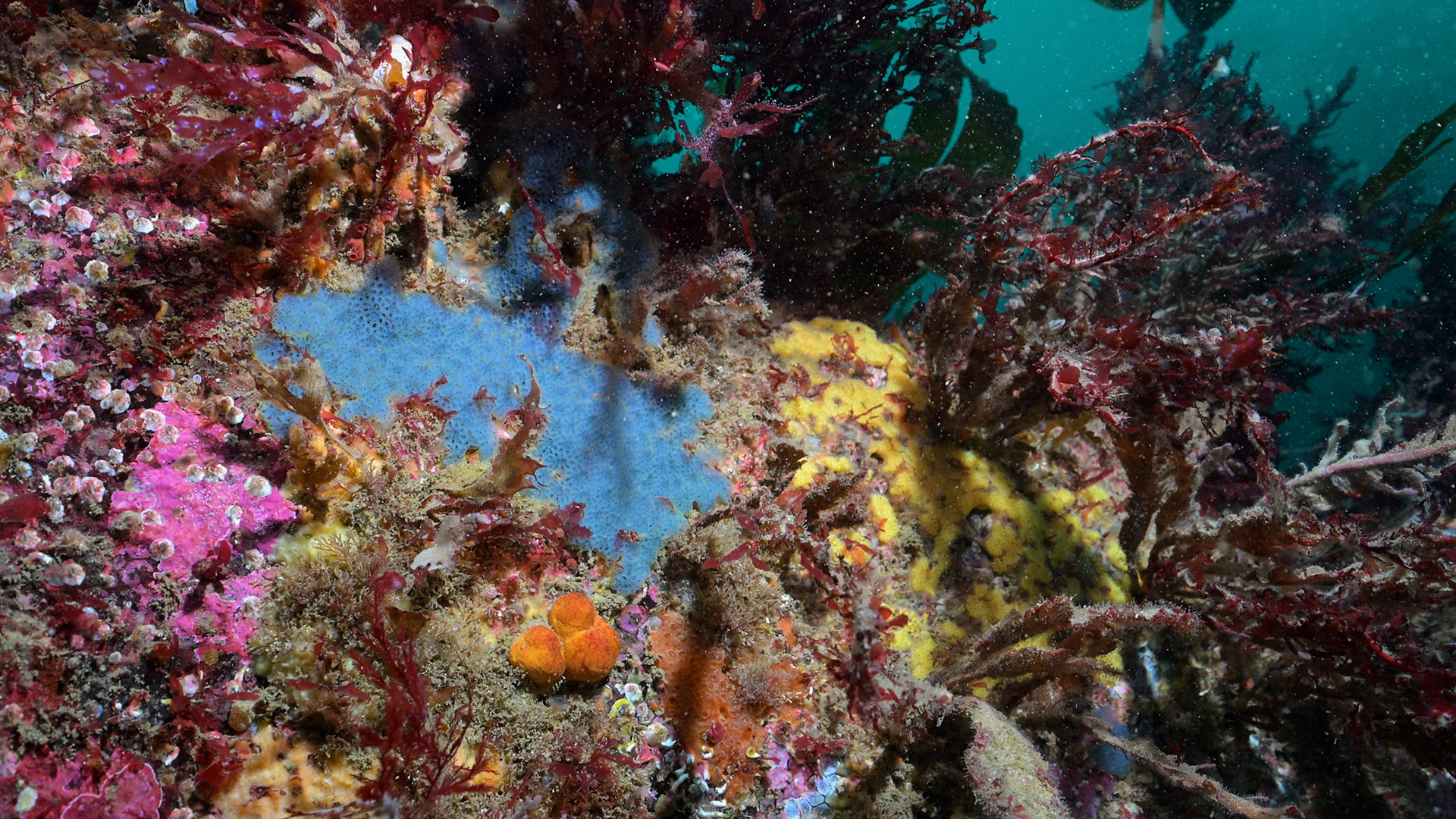
Survey number: 780 Event number: 20241005/01 Date: 2024-10-05 GPS: 55.22385,-6.63403. Depth: -12.0 to -27.0 m. [ View map ]
Site Description: Bay on North side of the Skerries, partly out of the tidal stream and full wave exposure. Seabed of rounded boulders in moderate tidal stream, exposed to open sea to the North, Flustra foliacea common below 20 m; and bedrock wall from 20m to 12 m with Laminaria hyperborea, silty with strong tidal streams and fully exposed to wave action from the North.
Species list (51 species recorded):
PORIFERA
Dysidea fragilis
Raspailia ramosa
Stelligera montagui
Polymastia boletiformis
Cliona celata
Phorbas fictitius
Mycale rotalis
CNIDARIA
Tubularia indivisa
Amphisbetia operculata
Sertularella sp.
Sertularella polyzonias
Sertularia argentea
Nemertesia antennina
Nemertesia ramosa
Obelia geniculata
Alcyonium digitatum
Actinothoe sphyrodeta
Corynactis viridis
Caryophyllia smithii
ANNELIDA
Spirobranchus triqueter
CRUSTACEA
Balanus crenatus
Adna anglica
Cancer pagurus
MOLLUSCA
Calliostoma zizyphinum
Diaphorodoris alba
BRYOZOA
Crisia denticulata
Crisia eburnea
Alcyonidium diaphanum
Membranipora membranacea
Flustra foliacea
Securiflustra securifrons
ECHINODERMATA
Crossaster papposus
Henricia oculata
Marthasterias glacialis
Echinus esculentus
Holothuria forskali
TUNICATA
Botryllus renierii
PISCES
Taurulus bubalis
Centrolabrus exoletus
Labrus bergylta
Labrus mixtus
Parablennius gattorugine
RHODOPHYTA
Dilsea carnosa
Heterosiphonia plumosa
Acrosorium venulosum
Cryptopleura ramosa
Delesseria sanguinea
Erythroglossum laciniatum
Membranoptera alata
CHROMOPHYTA
Dictyota dichotoma
Laminaria hyperborea
Biotope 1 : Mixed faunal turf communities. CR.HCR.Xfa (EUNIS A4.13)
PORIFERA
Raspailia ramosa R
Stelligera montagui R
Polymastia boletiformis R
Cliona celata F
Phorbas fictitius R
Mycale rotalis R
CNIDARIA
Tubularia indivisa O
Sertularella sp. F
Sertularella polyzonias O
Sertularia argentea O
Nemertesia antennina C
Nemertesia ramosa O
Caryophyllia smithii O
Caryophyllia smithii C
ANNELIDA
Spirobranchus triqueter F
CRUSTACEA
Balanus crenatus O
Adna anglica C
Cancer pagurus R
MOLLUSCA
Calliostoma zizyphinum O
Diaphorodoris alba R
BRYOZOA
Crisia denticulata F
Crisia eburnea O
Alcyonidium diaphanum C
Flustra foliacea C
Securiflustra securifrons F
ECHINODERMATA
Crossaster papposus R
Henricia oculata R
Marthasterias glacialis R
Echinus esculentus C
Holothuria forskali R
TUNICATA
Botryllus renierii O
PISCES
Centrolabrus exoletus O
Labrus bergylta O
Labrus mixtus R
Parablennius gattorugine R
RHODOPHYTA
Heterosiphonia plumosa F
Acrosorium venulosum F
Delesseria sanguinea O
Erythroglossum laciniatum F
CHROMOPHYTA
Dictyota dichotoma O
Biotope 2 : Laminaria hyperborea forest with dense foliose red seaweeds on exposed upper infralittoral rock. IR.HIR.KFaR.LhypR.Ft (EUNIS A3.1151)
PORIFERA
Dysidea fragilis O
CNIDARIA
Amphisbetia operculata O
Obelia geniculata C
Alcyonium digitatum F
Actinothoe sphyrodeta O
Corynactis viridis F
CRUSTACEA
Balanus crenatus C
MOLLUSCA
Calliostoma zizyphinum O
BRYOZOA
Membranipora membranacea C
TUNICATA
Botryllus renierii O
PISCES
Taurulus bubalis R
RHODOPHYTA
Dilsea carnosa O
Cryptopleura ramosa F
Delesseria sanguinea C
Membranoptera alata O
CHROMOPHYTA
Dictyota dichotoma F
Laminaria hyperborea C
| Previous site | Next site |