Marine Biodiversity Data Portal - NI

Archway, The North Wall, Rathlin Island
Survey number: 780 Event number: 20240520/01 Date: 2024-05-20 GPS: 55.30788,-6.26920. Depth: -15.0 to -35.0 m. [ View map ]
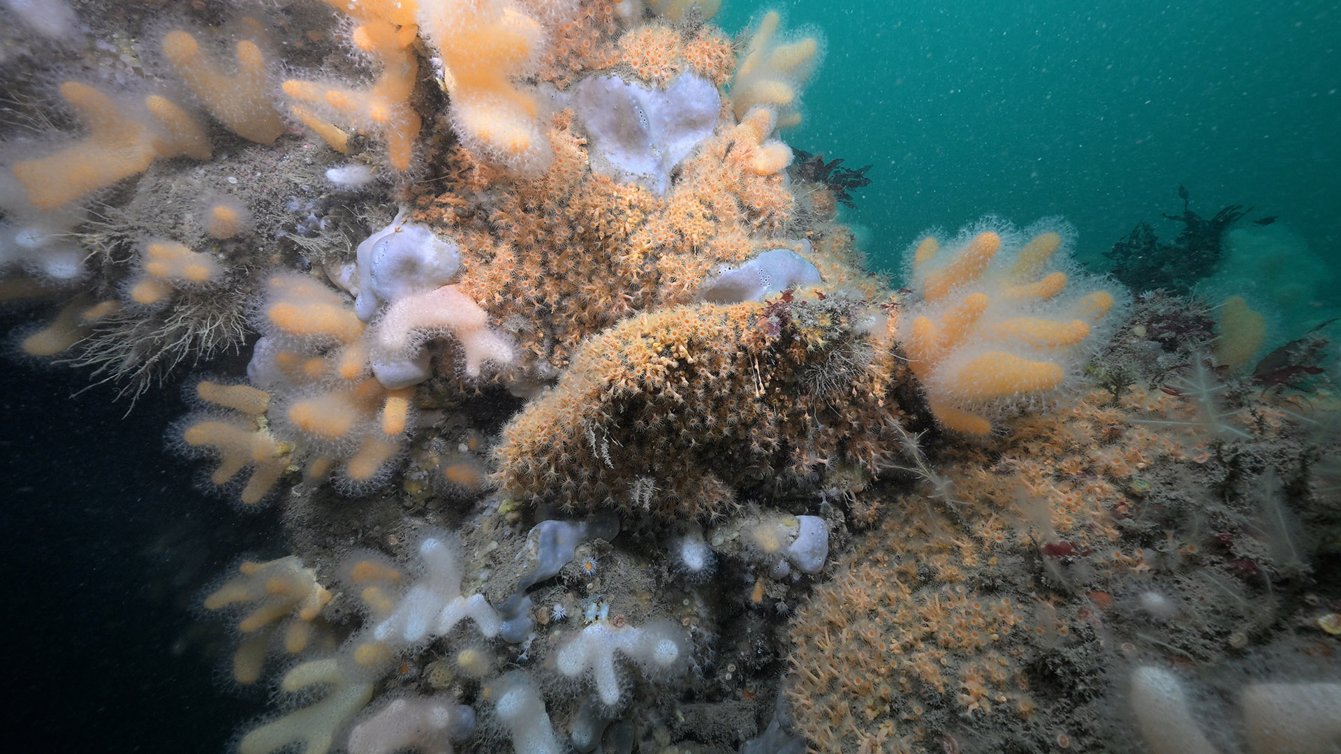
Site Description: Vertical limestone wall with archway on Rathlin's north wall. Upper circalittoral bedrock with Delesseria sanguinea, Alcyonium digitatum and Pachymatisma johnstonia, lower circalittoral boulders on flat, silty bedrock. Boulders are large and angular.
 |
 |
 |
 |
 |
 |
 |
 |
 |
 |
 |
 |
 |
 |
 |
 |
 |
 |
 |
 |
 |
 |
 |
 |
 |
 |
 |
 |
 |
 |
[ More images ] (30/88)
Species list (68 species recorded):
Aplysilla sulfurea
Pachymatisma johnstonia
Dercitus bucklandi
Axinella infundibuliformis
Raspailia ramosa
Tethyspira spinosa
Stelligera stuposa
Polymastia boletiformis
Polymastia penicillus
Sphaerotylus renoufi
Iophon hyndmani
Iophonopsis nigricans
Hemimycale columella
Hymedesmia jecusculum
Hymedesmia paupertas
Hymedesmia rathlinia
Myxilla fimbriata
Desmacella cf. annexa
Spongosorites calcicola
Suberites carnosus
Haliclona urceolus
Haliclona viscosa
CNIDARIA
Tubularia indivisa
Ectopleura larynx
Halecium halecinum
Abietinaria abietina
Sertularia argentea
Tamarisca tamarisca
Nemertesia antennina
Nemertesia ramosa
Schizotricha frutescens
Aglaophenia tubulifera
Alcyonium digitatum
Alcyonium hibernicum
Parazoanthus anguicomus
Parazoanthus axinellae
Metridium senile
Actinothoe sphyrodeta
Caryophyllia inornata
Caryophyllia smithii
ANNELIDA
Bispira volutacornis
CRUSTACEA
Cancer pagurus
MOLLUSCA
Calliostoma zizyphinum
Tectura virginea
Tritonia hombergii
Polycera faeroensis
Polycera kernowensis
Antiopella cristata
Edmundsella pedata
BRYOZOA
Caberea boryi
Porella compressa
Parasmittina trispinosa
ECHINODERMATA
Henricia oculata
Asterias rubens
Marthasterias glacialis
Echinus esculentus
TUNICATA
Aplidium nordmanni
Aplidium punctum
Lissoclinum weigelei
Dendrodoa grossularia
Botryllus renierii
PISCES
Taurulus bubalis
Ctenolabrus rupestris
RHODOPHYTA
Rhodophyllis divaricata
Meredithia microphylla
Delesseria sanguinea
CHROMOPHYTA
Alaria esculenta
Laminaria hyperborea
Biotope 1 : Sponges, cup corals and anthozoans on shaded or overhanging circalittoral rock. Limestone archway. CR.FCR.Cv.SpCup (EUNIS A4.711)
Aplysilla sulfurea R
Pachymatisma johnstonia C
Axinella infundibuliformis F
Raspailia ramosa R
Tethyspira spinosa R
Stelligera stuposa O
Polymastia boletiformis R
Polymastia penicillus O
Sphaerotylus renoufi R
Iophon hyndmani F
Iophonopsis nigricans O
Hemimycale columella O
Hymedesmia jecusculum O
Hymedesmia paupertas O
Hymedesmia rathlinia O
Myxilla fimbriata R
Desmacella cf. annexa C
Spongosorites calcicola A
Suberites carnosus O
Haliclona urceolus O
Haliclona viscosa R
CNIDARIA
Tubularia indivisa O
Ectopleura larynx O
Halecium halecinum O
Abietinaria abietina O
Sertularia argentea O
Tamarisca tamarisca R
Nemertesia antennina F
Nemertesia ramosa O
Schizotricha frutescens R
Aglaophenia tubulifera O
Alcyonium digitatum C
Alcyonium hibernicum F
Parazoanthus anguicomus C
Parazoanthus axinellae F
Actinothoe sphyrodeta F
Caryophyllia inornata O
Caryophyllia smithii F
ANNELIDA
Bispira volutacornis O
CRUSTACEA
Cancer pagurus R
MOLLUSCA
Calliostoma zizyphinum O
Tectura virginea P
Tritonia hombergii R
Polycera faeroensis R
Polycera kernowensis O
Antiopella cristata R
BRYOZOA
Caberea boryi O
Porella compressa O
ECHINODERMATA
Henricia oculata R
Asterias rubens R
Marthasterias glacialis R
Echinus esculentus R
TUNICATA
Aplidium nordmanni O
Aplidium punctum O
Lissoclinum weigelei O
Dendrodoa grossularia O
Botryllus renierii R
PISCES
Taurulus bubalis R
Ctenolabrus rupestris R
RHODOPHYTA
Rhodophyllis divaricata F
Delesseria sanguinea C
Biotope 2 : Moderate energy circalittoral rock. CR.MCR (EUNIS A4.2)
Alcyonium digitatum C
Metridium senile R
Caryophyllia smithii F
BRYOZOA
Parasmittina trispinosa O
Biotope 3 : Upper circalittoral limestone bedrock at 25 m. High energy circalittoral rock CR.HCR (EUNIS A4.1)
Dercitus bucklandi R
MOLLUSCA
Edmundsella pedata R
RHODOPHYTA
Meredithia microphylla R
CHROMOPHYTA
Alaria esculenta R
Laminaria hyperborea C
| Previous site | Next site |