Marine Biodiversity Data Portal - NI

N of South Rock, Strangford Lough
Survey number: 561 Event number: 20030721/03 Date: 2003-07-21 GPS: 54.47193,-5.58187. Depth: 15.1 m. [ View map ]
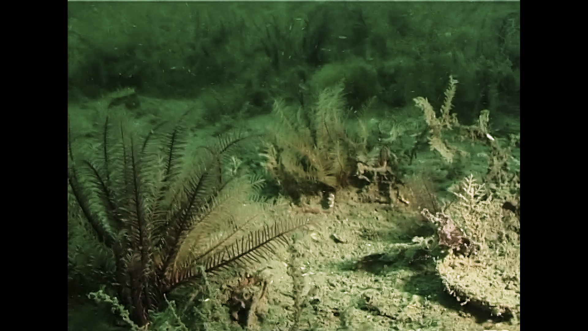
Site Description: Mud with scattered broken (mainly Modiolus modiolus shell) & Alcyonium digitatum / Cylista elegans. Some hedgehog stones maerl towards end of dive.
Species list (32 species recorded):
PORIFERA
Sycon ciliatum
Amphilectus fucorum
Suberites carnosus
CNIDARIA
Halecium halecinum
Hydrallmania falcata
Nemertesia antennina
Nemertesia ramosa
Alcyonium digitatum
Synarachnactis lloydii
Urticina eques
Cylista elegans
ANNELIDA
Myxicola infundibulum
CRUSTACEA
Pagurus bernhardus
Inachus dorsettensis
Macropodia rostrata
Polybius depurator
Necora puber
MOLLUSCA
Calliostoma zizyphinum
Buccinum undatum
Pecten maximus
Aequipecten opercularis
ECHINODERMATA
Antedon bifida
Henricia oculata
Asterias rubens
Leptasterias muelleri
Thyone roscovita
TUNICATA
Distaplia rosea
Ascidiella aspersa
Ascidia virginea
PISCES
Callionymus lyra
Pomatoschistus pictus
RHODOPHYTA
Lithothamnion glaciale
Sycon ciliatum
Amphilectus fucorum
Suberites carnosus
CNIDARIA
Halecium halecinum
Hydrallmania falcata
Nemertesia antennina
Nemertesia ramosa
Alcyonium digitatum
Synarachnactis lloydii
Urticina eques
Cylista elegans
ANNELIDA
Myxicola infundibulum
CRUSTACEA
Pagurus bernhardus
Inachus dorsettensis
Macropodia rostrata
Polybius depurator
Necora puber
MOLLUSCA
Calliostoma zizyphinum
Buccinum undatum
Pecten maximus
Aequipecten opercularis
ECHINODERMATA
Antedon bifida
Henricia oculata
Asterias rubens
Leptasterias muelleri
Thyone roscovita
TUNICATA
Distaplia rosea
Ascidiella aspersa
Ascidia virginea
PISCES
Callionymus lyra
Pomatoschistus pictus
RHODOPHYTA
Lithothamnion glaciale
Biotope 1 : Circalittoral mixed sediment. SS.SMx.CMx (EUNIS A5.44)
PORIFERA
Sycon ciliatum O
Amphilectus fucorum O
Suberites carnosus O
CNIDARIA
Halecium halecinum O
Hydrallmania falcata F
Nemertesia antennina O
Nemertesia ramosa O
Alcyonium digitatum O
Synarachnactis lloydii R
Urticina eques R
Cylista elegans O
ANNELIDA
Myxicola infundibulum R
CRUSTACEA
Pagurus bernhardus O
Inachus dorsettensis O
Macropodia rostrata O
Polybius depurator O
Necora puber O
MOLLUSCA
Calliostoma zizyphinum R
Buccinum undatum O
Pecten maximus C
Aequipecten opercularis O
ECHINODERMATA
Antedon bifida A
Henricia oculata R
Asterias rubens C
Leptasterias muelleri R
Thyone roscovita O
TUNICATA
Distaplia rosea O
Ascidiella aspersa O
Ascidia virginea R
PISCES
Callionymus lyra R
Pomatoschistus pictus F
RHODOPHYTA
Lithothamnion glaciale R
Sycon ciliatum O
Amphilectus fucorum O
Suberites carnosus O
CNIDARIA
Halecium halecinum O
Hydrallmania falcata F
Nemertesia antennina O
Nemertesia ramosa O
Alcyonium digitatum O
Synarachnactis lloydii R
Urticina eques R
Cylista elegans O
ANNELIDA
Myxicola infundibulum R
CRUSTACEA
Pagurus bernhardus O
Inachus dorsettensis O
Macropodia rostrata O
Polybius depurator O
Necora puber O
MOLLUSCA
Calliostoma zizyphinum R
Buccinum undatum O
Pecten maximus C
Aequipecten opercularis O
ECHINODERMATA
Antedon bifida A
Henricia oculata R
Asterias rubens C
Leptasterias muelleri R
Thyone roscovita O
TUNICATA
Distaplia rosea O
Ascidiella aspersa O
Ascidia virginea R
PISCES
Callionymus lyra R
Pomatoschistus pictus F
RHODOPHYTA
Lithothamnion glaciale R
| Previous site | Next site |