Earth Science Conservation Review
| Doraville Ridge - Palaeogene | Fermanagh |

| Site Type: | Quarry (working) |
| Site Status: | ESCR |
| Council area: | Fermanagh District Council |
| Grid Reference: | H19355655,H200558 |
| Google maps: | 54.45709,-7.7024 |
| Rocks | |
|---|---|
| Rock Age: | Tertiary (Tertiary Undifferentiated) |
| Rock Type: | Dolerite |
| Interest | |
| Minerals: | Cordierite, Sillimanite |
| Other interest: | Roadstone, dyke, multiple intrusion, Intrusion |
Summary of site:
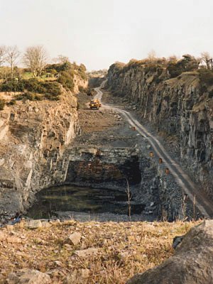
The rock of the Dora Ville Ridge, though only intermittently seen through the thick mantle of glacial deposits that obscures the solid geology beneath, extends over a length of 26km from Dora Ville (4.5km a little south of west of Irvinestown) to Carricknahorna East (about 6.5km north of Belleek).
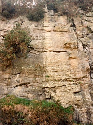
The ridge is the landscape expression of an exceptionally wide multiple dolerite dyke, a pathway through the fractured Devonian and Carboniferous bedrock of the area, repeatedly exploited by vast volumes of molten magma coursing up towards the surface. The width of the dyke exceeds 90m in a quarry at its south eastern end. Its trend (north-west/south-east) and chemical composition confirm its relationship to the Antrim and Londonderry basalts, created by massive eruptions around 60 million years ago during the early Tertiary.
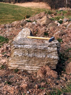
Many interesting features are associated with this dyke. The series of reactivations and its enormous thickness of searingly hot magma baked its walls and altered them (a process called thermal metamorphism). The lime-rich Devonian mudstones were converted to a tough welded rock called a hornfels containing newly formed minerals such as sillimanite and sanidine (both indicating that very high temperatures were reached).
The contacts between the different injections of molten magma have a wavy banded appearance and there are subtle differences between adjacent pulses. The dolerites are coarse grained and their composition and mineral content vary from margin to centre. Near the margin they contain the mineral olivine and a single pyroxene but towards the centre the olivine changes, becoming more iron rich, and a second pyroxene appears. There are also differences in texture (the whole appearance of the rock in terms of particle sizes and shapes, crystal forms and arrangement) across this range.
There are also pipe amygdales in the rock (once open tubes, venting gas continuously to the surface through the molten rock, now filled with linings of zeolite minerals). The pipes suggest pressures low enough to allow the molten rock to degas and indicate that the dyke was near the surface at this point.
This vast dyke almost certainly fed a surface fissure that erupted repeatedly over a sustained period during the general volcanicity that created the extensive lava fields of Antrim and Londonderry. There are many other dykes in the vicinity of similar age, suggesting that the lava fields almost certainly extended across this area too. All evidence is now gone, stripped by the erosion of the last 60 million years. There are gravity anomalies (slight gravity variations in the regional background, detected by a sensitive instrument called a gravity meter) in the area, suggesting that a mass of basic rock at depth may represent a possible source for the eruptions.
The quarry is worked for dolerite and if surviving faces at the close of working show sufficient of this complex geology, they should be designated and protected. The quarry is being extended and deepened and that could present serious future conservation and access problems due to unstable high faces and flooding when pumping ceases. There would also be the usual risk of overgrowth and dumping.
| Enlander, I., Dempster, M. & Doughty, P., 2025. Doraville Ridge - Palaeogene, County Fermanagh, site summary. [In] Earth Science Conservation Review. https://www.habitas.org.uk/escr/summary.php?item=80. Accessed on 2025-12-14 |
| Previous Site | Next Site |

