
Earth Science Conservation Review
| Red Arch, north of Waterfoot | Antrim |
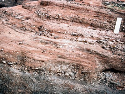
| Site Type: | Coastal section |
| Site Status: | ESCR |
| Council area: | Moyle District Council |
| Grid Reference: | D24352630 |
| Google maps: | 55.06891,-6.05421 |
| Rocks | |
|---|---|
| Rock Age: | Devonian (Upper Devonian) |
| Rock Name: | Red Arch Formation |
| Rock Type: | Conglomerate, Sand, Sandstone |
| Interest | |
| Other interest: | cross-bedding, massive |
Summary of site:
See Site Name 'Devonian - Red Arch Formation; Cushendall to Red Arch, Glenariff'
| Enlander, I., Dempster, M. & Doughty, P., 2026. Red Arch, north of Waterfoot, County Antrim, site summary. [In] Earth Science Conservation Review. https://www.habitas.org.uk/escr/summary.php?item=312. Accessed on 2026-09-12 |
| Previous Site | Next Site |