Earth Science Conservation Review
| Burntollet and Tamnymore Wood | Londonderry |
| Site Type: | Inland exposure, Stream section |
| Site Status: | ESCR |
| Grid Reference: | C505105 |
| Google maps: | 54.93998,-7.21203 |
| Rocks | |
|---|---|
| Rock Age: | Precambrian (Dalradian) |
| Rock Name: | Ballykelly Formation |
| Rock Type: | Limestone, Metabasite, Pelitic rock, Psammite, Semi-pelitic rock |
| Interest | |
Summary of site:
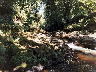
In the bed and along the north bank of the Burntollet River at this locality a thickness of about 50m of rock can be seen over a stretch of 500m. The rocks are metamorphosed (altered by heat and pressure at depth in the Earth) and are graded as greenschists indicating a fairly low grade of change with temperatures below 500ºC. They are part of a belt of Dalradian rocks and are grouped in its topmost division, the Southern Highland Group. This is further subdivided, in date order from the oldest, into the Claudy, Ballykelly and Londonderry Formations. The rocks at Burntollet and Tamnymore Wood are very near the base of the Ballykelly Formation, approximately 580 million years old.
Examination of the rocks shows them to be pelites and semipelites (originally mudstones and shales) and finely layered psammites (originally sandstones and silts). There are also bands of bluish grey to black limestones. Importantly, a massive dark grey-green rock called metabasite is also present. It was originally a basic igneous rock, either basalt or dolerite, indicating that volcanicity is part of the history of this sequence. All the sediments are unsorted, which means they were of mixed grain sizes, typical of submarine environments where sheets of sediment slide down gentle inclines mixing to create turbidity currents. The sediments settle in deep water although they may have originated on shallow, offshore shoals.
Just over the river to the south are the psammites of the Claudy Formation which lie immediately below the Ballykelly Formation, clearly identifying the rocks to the north as the lowest Ballykelly Beds.
Around 600 million years ago the giant supercontinent of Gondwana that straddled the South Pole showed indications of instability. Over the next few million years a new continent, Laurentia, separated from it and drifted off northwards towards the equator. Laurentia included what would eventually become, some 600 million years later, North America, Greenland, the northern half of Ireland and all of Scotland. The rocks seen at Burntollet were formed in the early part of this separation when the Earth's crust on the floor of the ocean was stretching and deepening fractures filled with molten matter injected from below.
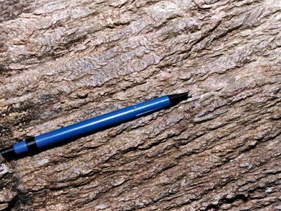
These rocks have a second claim to importance because they have a long structural history resulting from their deep burial, metamorphism and deformation. Cleavage planes (lineations responding to pressure) are strongly marked and consistent (east-west, inclined to the north) and they appear to deform an earlier and steeper structural fabric. There are also minor folds inclined to the east and north east. Regionally this locality is on the northern, upward facing, limb of an enormous overturned fold.
All these structures were formed in the early stages of the progressive collision of Laurentia with more fragments of Gondwana slowly converging from the south east. This period of compression and buckling happened about 480 million years ago in the early Ordovician period and is called the Grampian orogeny.
Much of this site is in public ownership, with the long-term protection that offers and the outcrops are so extensive that collecting activity need not be restricted.
| Enlander, I., Dempster, M. & Doughty, P., 2025. Burntollet and Tamnymore Wood, County Londonderry, site summary. [In] Earth Science Conservation Review. https://www.habitas.org.uk/escr/summary.php?item=150. Accessed on 2025-10-23 |
| Previous Site | Next Site |

