Earth Science Conservation Review
| Barnes Burn - Dalradian | Tyrone |
| Site Type: | Stream section |
| Site Status: | ESCR |
| Grid Reference: | H562905 |
| Google maps: | 54.75974,-7.127 |
| Rocks | |
|---|---|
| Rock Age: | Precambrian (Dalradian) |
| Rock Name: | Clogherny Member, Glenelly Formation, Southern Highlands Group |
| Rock Type: | Calcareous schist, Schist |
| Interest | |
Summary of site:
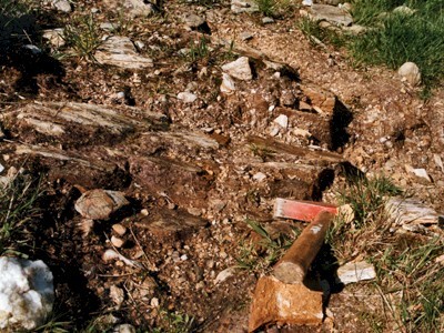
Barnes Burn drains the northern slope of Mullaghbolig and feeds into the Glenelly River in an area of fine upland scenery. Below the bridge for about 200m downstream there are intermittent outcrops of heavily altered (metamorphosed) ancient rocks. They are mainly changed impure shales with a green to pale grey/white colouration due to their mineral content. Within this section of rocks there is a distinctive subdivision, the Clogherny Member, consisting of pale green to off-white, pearly, quartz-mica schists and gritty, quartz-rich flagstones with silvery partings that contain up to 5% calcium carbonate. The rocks are tilted steeply, at 45º to the north west. The Clogherny Member is part of the Glenelly Formation, also defined in this region, which forms a substantial part of the Southern Highland Group of the Dalradian (the final stage of the Precambrian).
The Clogherny Member records a phase in the evolution of a giant supercontinent known as Laurentia, around 580 million years ago. This huge landmass included parts of what are now North America (including northern Canada), Greenland and north-west Europe. The fringes of the Earth's crust around this continent became unstable and subsided, forming wide depressions on the ocean floor that filled with destabilised sediments that slid down the continental slope. The Clogherny Member, much altered though it is, seems to represent a distinctive set of conditions on this ocean floor. The presence of carbonate suggests that a period of shallow, more oxygenated water prevailed for a time.
The continent then accumulated late rocks but around 400 million years ago a major continental collision occurred and the Dalradian rocks, by then deeply buried, were subjected to enormous pressures and high temperatures. This regional metamorphism created and aligned new stable minerals, changing the sediments to the schists and other metasediments seen at Barnes Burn. These enormous forces also created a gigantic fold in the rocks, affecting all the Dalradians in the Sperrin Mountains. This fold was driven over to the south so that the southerly limb became inverted. The Barnes Burn rocks are part of this limb and are consequently upside-down. The base of the succession is therefore near the bridge and the rocks become progressively younger down stream.
This exposure is the stratotype (the section defining the member for the purposes of comparison) of the Clogherny Member and is therefore of fundamental importance. The section is accessible and without threat.
| Enlander, I., Dempster, M. & Doughty, P., 2025. Barnes Burn - Dalradian, County Tyrone, site summary. [In] Earth Science Conservation Review. https://www.habitas.org.uk/escr/summary.php?item=137. Accessed on 2025-04-03 |
| Previous Site | Next Site |

