Earth Science Conservation Review
| Mournes - Rocky Mountain | Down |
| Site Type: | Crag, Crags |
| Site Status: | ASSI |
| Council area: | Newry & Mourne District Council |
| Grid Reference: | J234258 |
| Google maps: | 54.16684,-6.11058 |
| Rocks | |
|---|---|
| Rock Age: | Tertiary (Eocene) |
| Rock Name: | Granite |
| Rock Type: | Granite |
| Interest | |
| Other interest: | drusy, ring-dyke, Contact, Intrusion, Sheep farming |
Summary of site:
The Mourne granites were emplaced by a process called cauldron subsidence. The first centre of activity produced the three granites of the eastern Mournes (described as G1 to G3) and as magmatic activity shifted west, the two granites emplaced there, G4 and G5, marked the final stage of granitic activity. The process of cauldron subsidence involves the initiation and extension of a circular fracture above a magma chamber (a large mass of molten rock at depth) to isolate a sub-cylindrical block of overlying rock several kilometres across that then slowly sinks into the molten mass below. The magma flows around the sinking block to occupy the space above, forming ring dykes, now solid sheets of rock defining the subsiding block. The entire process occurs at depth in the earth's crust, never breaking ground surface.
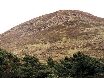
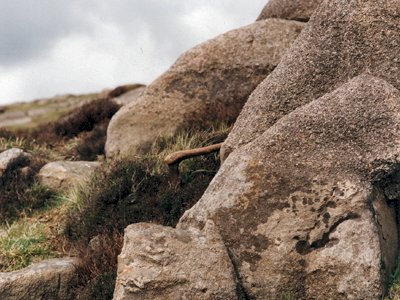
There were two such events in the Mournes, one in the east, the other in the west. On Rocky Mountain, 3.5 km south east of Hilltown, the junction between the G4 and G5 granites, the western cauldron, can be seen. G4 is the upper granite, forming an arched roof over G5 which can be seen almost completely surrounded by G4 which has been unroofed and stripped away by over 50 million years of erosion to expose it. The contact between these granites is clearly exposed east and south east of Rocky Mountain. Typically G4 is medium grained and coloured purple to pink by its potassium feldspars. G5, in contrast, is finer-grained, distinctly blue-grey and contains many crystal-lined cavities. The contact between the granites is sharp and inclined gently to the north. In a few places G5 penetrates G4.
51 million years ago these two granites were emplaced quietly without much disturbance to the surrounding Silurian sediment except in the immediate vicinity of the subsiding block. The form of the granite intrusions, with arched tops, is described as laccolithic. Volatile compounds in G5 formed pockets of gases that were trapped below the G4 cap creating cavities.
The value of the Rocky Mountain site lies in the long outcrop of the junction between G4 and G5 which is probably the best in the Mournes and makes clear the structural relationship between the two.
The site is sufficiently distant from the road to prevent damage from over-sampling by educational parties and quarrying, while unlikely, should be closely managed if it is ever permitted.
| Enlander, I., Dempster, M. & Doughty, P., 2025. Mournes - Rocky Mountain, County Down, site summary. [In] Earth Science Conservation Review. https://www.habitas.org.uk/escr/summary.php?item=1113. Accessed on 2025-04-03 |
| Previous Site | Next Site |

