Earth Science Conservation Review
| Mournes - Eagle Rock | Down |

| Site Type: | Cliff, Crag, Crags |
| Site Status: | ASSI |
| Council area: | Down District Council |
| Grid Reference: | J358284 |
| Google maps: | 54.18705,-5.91968 |
| Rocks | |
|---|---|
| Rock Age: | Tertiary, Silurian (Eocene, Silurian Undifferentiated) |
| Rock Name: | Granite |
| Rock Type: | Granite, Hornfels |
| Interest | |
| Other interest: | drusy, ring-dyke, Contact, Intrusion, Sheep grazing, outdoor pursuits. |
Summary of site:
The three granites of the eastern Mournes, numbered in the order of their emplacement by J E Richey in his original mapping and description in 1927, as G1, G2 and G3, were formed by a process called cauldron subsidence. In this, above a massive chamber of molten rock (magma) deep in the earth's crust, a cylindrical fracture, kilometres across, propagates upwards isolating a block that then detaches, still at great depth. This freed cylinder then subsides and the magma flows around it, through the fracture, to gather in the chamber above. This process was repeated twice in the eastern Mournes to give the first three granites, all similar in composition but recognisably different in appearance. This account describes and interprets the exposures of the junction between G1, G2 and the enclosing country rock that in this area is altered Silurian sediments. The events took place 56 million years ago.
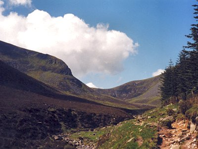
The erosion of the last 56 million years has stripped away the rocks above, laying bare the roof of the granites. Most of the feldspar-rich G1 was removed in this way but remnants form the summits of Slieve Donard, Slieve Commedagh and Slieve Corragh. Eagle Rock is the steep corrie cliff on the northern slope of Slieve Donard and here G1 can be seen in vertical contact with the altered Silurian sediments of the country rock, both resting on top of the Quartz-rich G2. The contact between the granites is almost horizontal with a slight tilt to the north. This gives support to the cauldron subsidence interpretation for granite emplacement as the flat top of the cylinder detaches with each reactivation. The flat-based, domed-top form of the intruded granite mass is described as a laccolith.
This is the best exposure of the G1, G2 contact in the Mournes and shows clearly how they relate to the country rock and for these reasons it is a designated Area of Special Scientific Interest (ASSI), the highest national status conferred and one that offers a high level of protection.
| Enlander, I., Dempster, M. & Doughty, P., 2025. Mournes - Eagle Rock, County Down, site summary. [In] Earth Science Conservation Review. https://www.habitas.org.uk/escr/summary.php?item=1105. Accessed on 2025-04-03 |
| Previous Site | Next Site |

