Earth Science Conservation Review
| Mournes - Bloody Bridge River Section | Down |
| Site Type: | Stream section |
| Site Status: | ASSI |
| Council area: | Newry & Mourne District Council |
| Grid Reference: | J387270,J373268 |
| Google maps: | 54.17371,-5.87594 |
| Rocks | |
|---|---|
| Rock Age: | Tertiary, Silurian (Eocene, Silurian Undifferentiated) |
| Rock Name: | Granite |
| Rock Type: | Granite, Hornfels, Porphyry |
| Interest | |
| Minerals: | Biotite, Diopside |
| Other interest: | ring-dyke, Contact, Intrusion, Heath land for sheep grazing. Mourne aquaduct pipi |
Summary of site:
The central Mourne Mountains are composed of five successive and closely related granites, three derived from an eastern centre and two from the west. This site traverses the country rock (the rock enclosing the granite) from the coast to the contact with the granite, the second granite (G2) in this case and continues west through a screen of country rock further into the G2 outcrop.
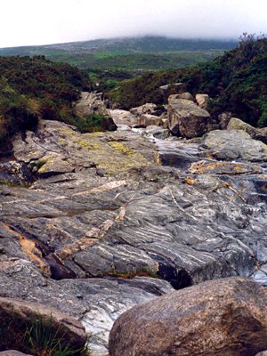
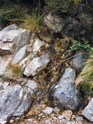
The country rock in the Bloody Bridge section is hornfelsed (baked, fused and toughened) Silurian mudstone in the form of alternating bands of greenish and purplish colour, each usually around 10 cm thick. These rocks are inclined to the east at around 30 degrees and remain so right up to the contact with the granite suggesting that there was no violent disturbance as the granite was emplaced, a process described as passive emplacement. As the contact with the granite is approached the hornfelses are transformed into diopsidic (diopside is a pale green mineral of the pyroxene group) and biotitic (dark coloured mica) bands resulting from the heating (thermal metamorphism) of the wall as the granite was emplaced. This altered zone of country rock around the granite forms its metamorphic aureole.
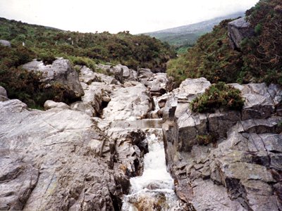
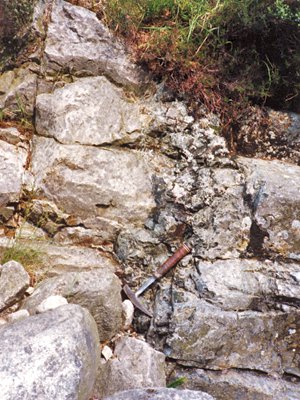
The contact between the country rock and G2 is 600 m upstream from the main road where it forms a sharp boundary clearly seen in the river bed. It appears to be near vertical, perhaps slightly inclined to the east. The granite has chilled against the country rock and there is a zone extending around 100 m west from the contact where it is noticeably finer-grained and best described as microgranite. After this the grain size increases to that normal for granites the west. A further 350 m west, beyond the confluence with the Glen Fofanny River, there is another vertical contact with the country rock but within a further 30 or so metres the river bed again exposes G2 granite. This narrow band of country rock can also be seen in the Glen Fofanny River to the north and the Crock Horn and Spence rivers to the south and it maps out as a narrow lenticular mass suspended in G2. Whether it is a sinking blade arrested as the granite congealed (a xenolith), a roof pendant projecting downwards from the long-eroded upper contact or still attached below ground or laterally is not known.
1.75 kilometres further west the track on the south bank of the river enters an abandoned quarry, still in the G2 granite, where spoils yield a variety of granite features including specimens with small intrusions of aplite (a sugary, fine-grained granite squeezed out of the main mass in the final stages of solidification).
The Mourne granites are thought to have originated when a cone of country rock above the magma chamber subsided into the molten rock below. The molten rock ascended around the subsiding block to occupy the space above, where it solidified. In the eastern Mournes this happened three times, at intervals, forming granites G1 to G3. The only remnants of G1 cap the three summits along the Slieve Donard ridge, the rest having been removed by erosion. G2 occupies the eastern part of the uplands as far west as Slievelamagan where G3 forms both slopes of the Silent Valley (the Kilkeel River valley) extending as far west as Deers Meadow.
The first three granites have been dated from their radioactive isotopes and have yielded an age of 56 million years before the present.
This is by far the best outcrop of the contact between the G2 granite and the Silurian country rock to be seen and has become a classic teaching and research arena enjoyed by generations of students and amateur geologists alike. The protection offered by its Area of Special Scientific Interest (ASSI) status is well deserved and the only threat to its geological enjoyment is posed by gorse overgrowth of access points to key parts of the section around the contact. The National Trust, the owners, should be encouraged to perform modest and sensitive pruning.
| Enlander, I., Dempster, M. & Doughty, P., 2025. Mournes - Bloody Bridge River Section, County Down, site summary. [In] Earth Science Conservation Review. https://www.habitas.org.uk/escr/summary.php?item=1104. Accessed on 2025-04-03 |
| Previous Site | Next Site |


