
Northern Ireland Priority species (NIPS)
| CRUSTACEA : Decapoda : Munididae | CRABS, SHRIMPS AND LOBSTERS |
Munida rugosa (Fabricius, 1775)
 |
| Munida rugosa |
A widespread and common species throughout the Northern Ireland coast, which probably holds the great majority of the Irish population.
In brief
- Found throughout the Northern Ireland coast.
- Found from the low intertidal, to about 100 m depth, on muddy/sandy areas with stones and rocks providing hiding places.
- Can be found throughout the year.
- Thought to be declining.
- Main threats likely to come from disruption of seabed habitat from use of mobile fishing gear.
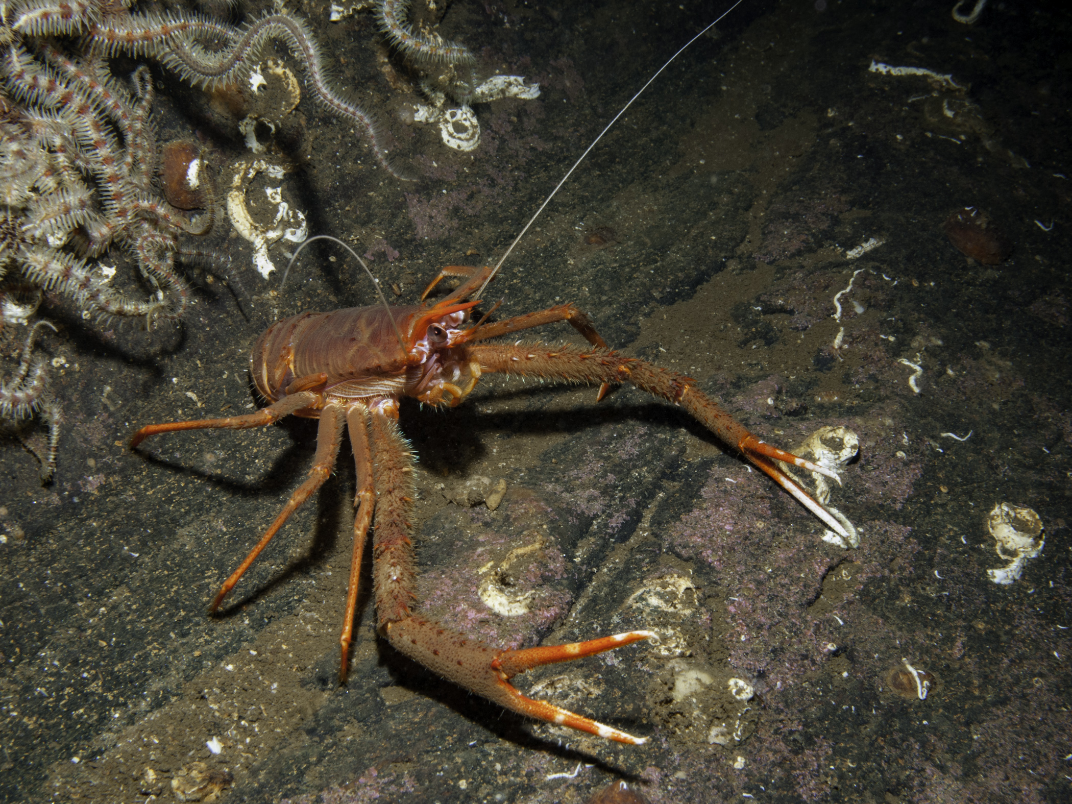
Species description: The rugose squat lobster grows to about 10cm in length when its abdomen is extended but this is misleading because normally it is curled up under the thorax, or central zone of the body. By flicking this abdomen sharply forward and under, it is able to dart backwards quite rapidly. It is an orange-reddish brown colour, with darker, or yellowish, striations across the carapace (upper shell) and abdomen, giving quite a distinctive pattern. The claws, spines and legs are all tipped white. The antennae are long, but not quite as long as the long thin spiny claws which are about double the length of the body.
Life cycle: Mature females carry eggs on their underside, where after mating and fertilisation, these develop into larval forms for about two weeks. They hatch into planktonic larvae, eventually settling after dispersal onto suitable habitat.
Similar species: No other Northern Irish squat lobster has such long claws or this combination of colours.
How to see this species: The species can be found throughout the year, and very widely throughout Northern Ireland coasts, in low intertidal zones through to depths of 50-100 m, on sandy or soft substrata, particularly where stony crevices also offer hiding places. Key locations in Northern Ireland include Portrush Skerries, all round Rathlin, the Maidens, off Muck Island, Larne and the Gobbins, Strangford Lough Narrows, and widely in its interior. Elsewhere in Ireland, it occurs on the south coast and is recorded off the Aran Islands, and in Britain there are numerous sites around western Scotland, north-eastern and eastern England.
Current status: Declining. Widespread in Northern Ireland, which is a stronghold for this species. The species has no legal protection.
Why is this species a priority in Northern Ireland?
- Criterion 2: Decline based on available data and expert judgement.
- Criterion 4: NI stronghold or endemic – both stronghold range/population and designation as ‘endemic’ subject to expert judgement.
Threats: Data for the exact conservation status of this species are lacking; however, its habitat of relatively level seabeds of sand and other sediments (although it utilises shelter from any boulders or stones) implies that it may well have suffered habitat loss from the use of mobile fishing gear.
Action: Records of new sites for this species, with details of habitat and population are always valuable. Observations with a photograph can be recorded using iNaturalist, find the MBDP-NI iNaturalist project here.
Alternatively, records can be sent to CEDaR, National Museums Northern Ireland, 153 Bangor Road, Cultra, Holywood, County Down, BT18 0EU. Tel 028 9039 5257, e-mail cedar.records@nationalmuseumsni.org, or via the online portal.
Objectives:
- Maintain the number of viable populations of the species
- Maintain the range of the species.
- Maintain appropriate management of known sites and consider further designation, for example in the Maidens.
- Protect sites of conservation importance from damage through contamination and physical disturbance or excessive use (for example, nutrient enrichment, dredging and development).
- Require EIAs for coastal developments to examine potential effects on nearshore areas.
- Monitor any impact of dump sites on inshore sublittoral sediment habitats, communities and wildlife, and taking action as appropriate.
- Develop and implement strategies for the conservation and management of the wider marine environment at local, regional and national levels. For example, integrated Coastal Management Plans, water quality objectives, pollution control and avoidance measures. Species recovery and habitat restoration programmes should be included.
Conservation:
- Strangford Lough is a Marine Protected Area with multiple designations.
- Rathlin Island is a Marine Protected Area with multiple designations.
- There are Habitat Action Plans for Sublittoral Sands and Gravel.
Distribution Map from NBN: Munida rugosa at National Biodiversity Network mapping facility, data for UK.
iNaturalist: Munida rugosa at iNaturalist World Species Observations database.
WoRMS: Munida rugosa at World Register of Marine Species. Accepted name: Munida rugosa (Fabricius, 1775). AphiaID: 107160.
Classification: Biota; Animalia; Arthropoda; Crustacea; Multicrustacea; Malacostraca; Eumalacostraca; Eucarida; Decapoda; Pleocyemata; Anomura; Galatheoidea; Munididae; Munida
| Previous species | Next species |
| Adapted from Allen & Mellon Environmental Ltd. (2026). Munida rugosa. (Fabricius, 1775). [In] Priority species, Marine Biodiversity Portal NI. https://www2.habitas.org.uk/marbiop-ni/priorityaccounts.php?item=S24950. Accessed on 2026-09-13 |